Australia 2008
|
Cairns, Gold Coast, Sydney, Melbourne
Link to Journey
|
No journey available
|
PDF of Journey
|
No PDF available
|
Date
|
October 7 - October 16, 2008
|
Leg
|
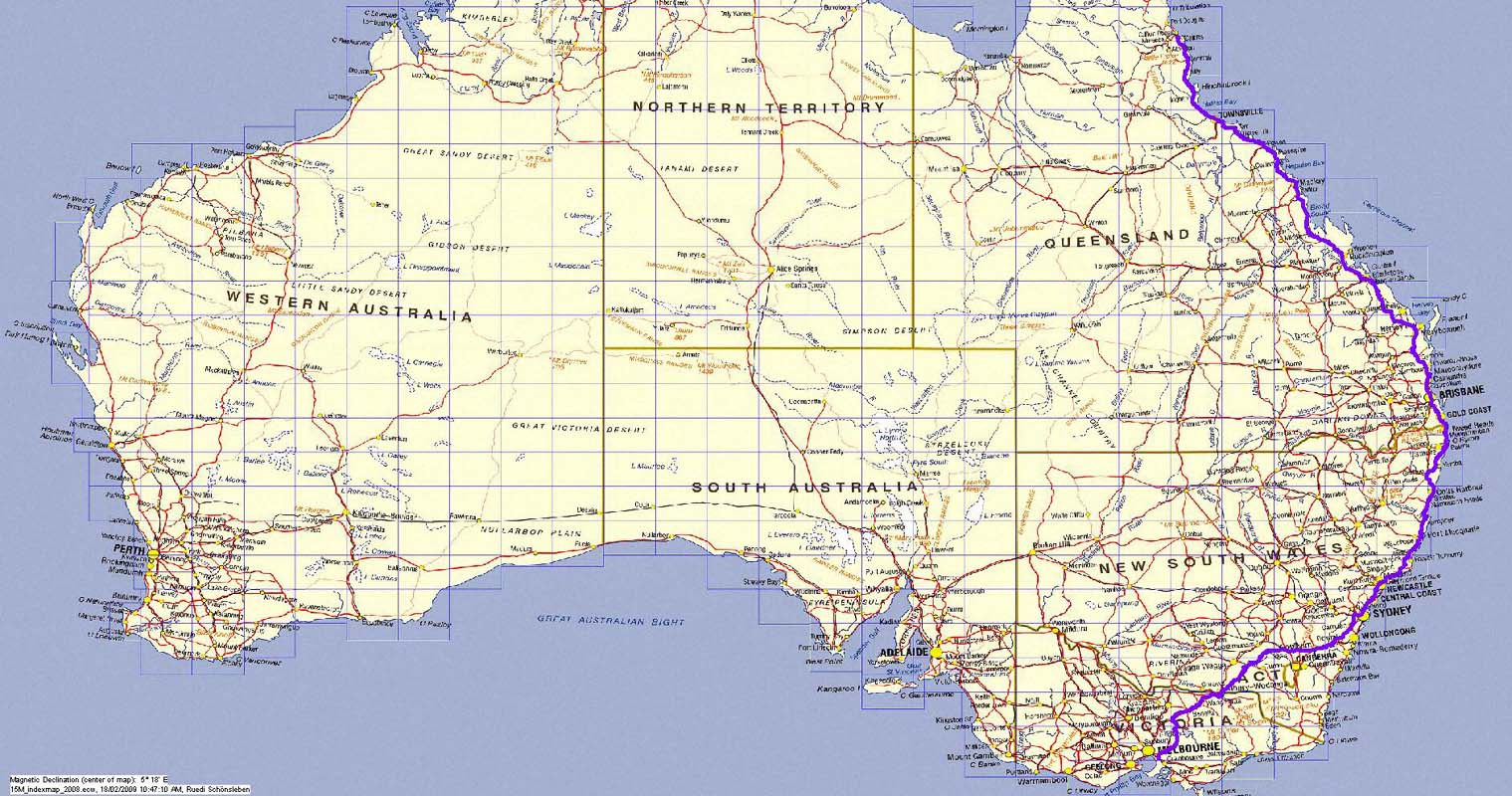
This is a transfer trip from Cairns via the Gold
Coast and Sydney to Melbourne to visit a few people
and to service and repair man and material.
|
|
Leg map (click to enlarge in separate
window)
|
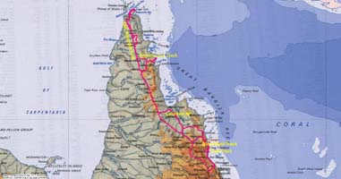
Cape York Peninsula
Link to Journey
|
Not yet available
|
PDF of Journey
|
Not yet available
|
Date
|
September 9 - October 3, 2008
|
Leg
|
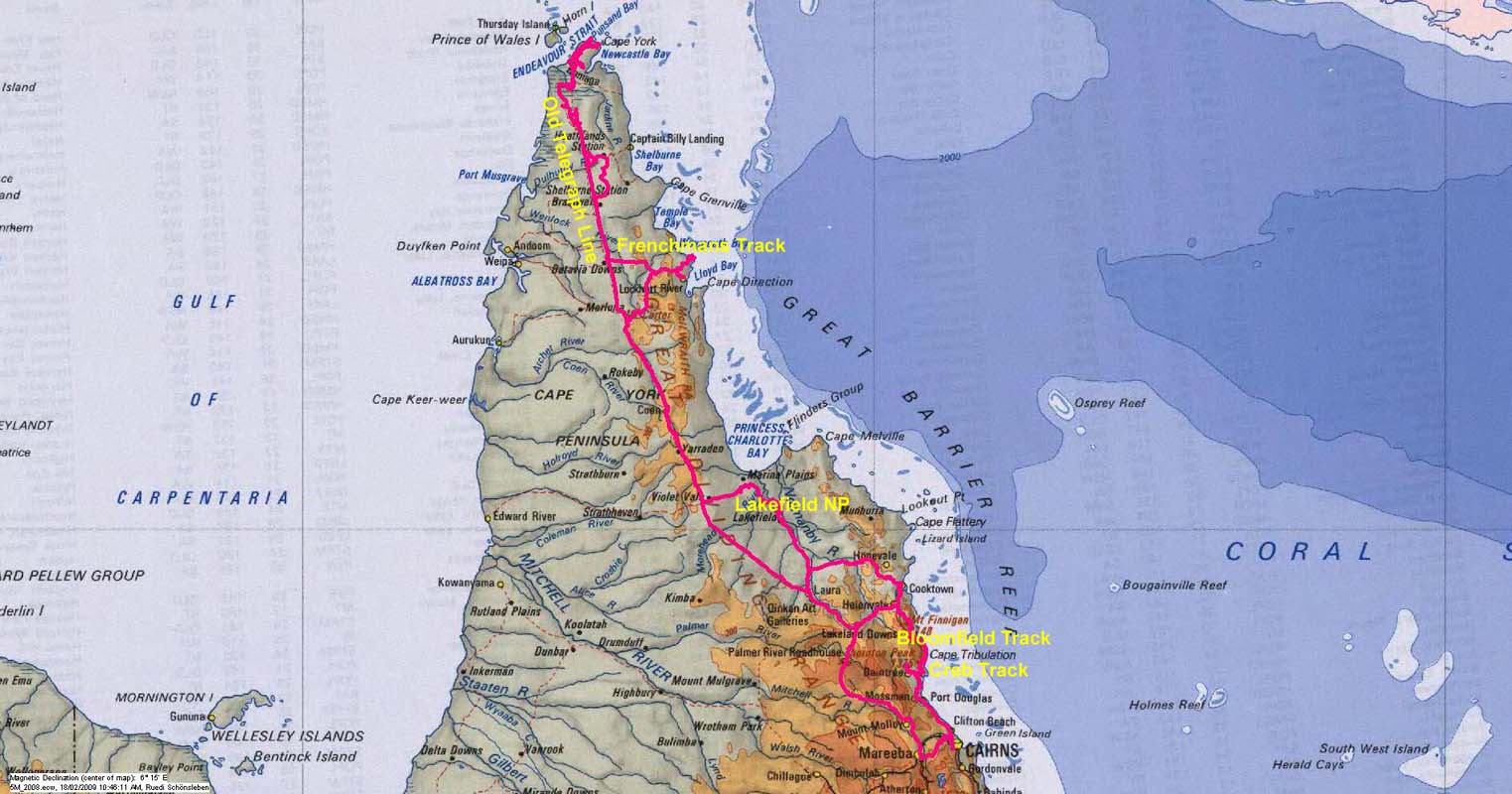
Cairns - CREB-Track - Daintree NP - Bloomfield Track
- Laura - Lilly Lagoon
- Old
Telegraph Line
(part 1) - Jardine River Ferry - Bamanga - Cape York
- Somerset - Seisia - Old Telegraph Line (part 2)
- Eliot Falls - Fruit Bat Falls - Frenchmans Road -
Iron Range NP - Lockhart River - Lakefield NP - Mareeba
- Cairns
|
|
Leg map (click to enlarge in separate
window)
|
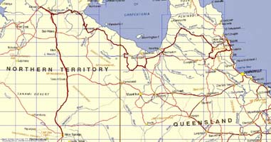
Savannah Way
Link to Journey
|
|
PDF of Journey
|

|
Date
|
August 10 - September 3, 2008
|
Leg
|
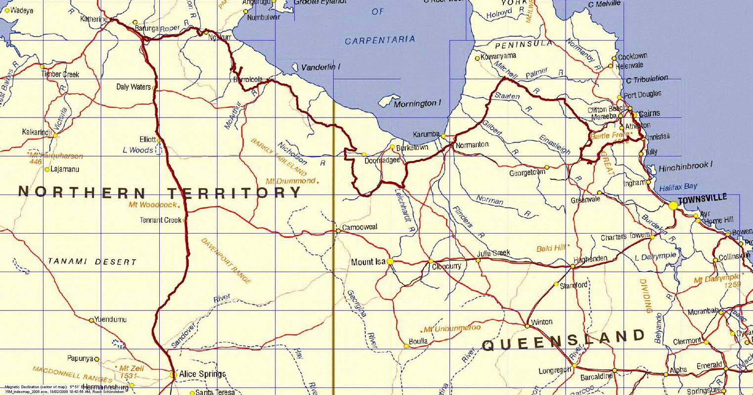
Alice Springs - Devils Marbles - Katherine - Mataranka
- Borroloola - Lawn Hill NP - Riversleigh - Gregory
Downs - Inverleigh - Normanton - Mitchell River - Chillagoe
- Undara Volcanic NP - Cairns
|
|
Leg map (click to enlarge in separate
window)
|
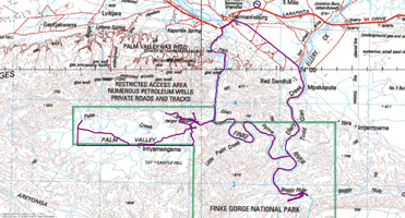
Volunteering at Palm Valley
Link to Journey
|
|
PDF of Journey
|
|
Date
|
July 3 - August 3, 2008
|
Leg
|
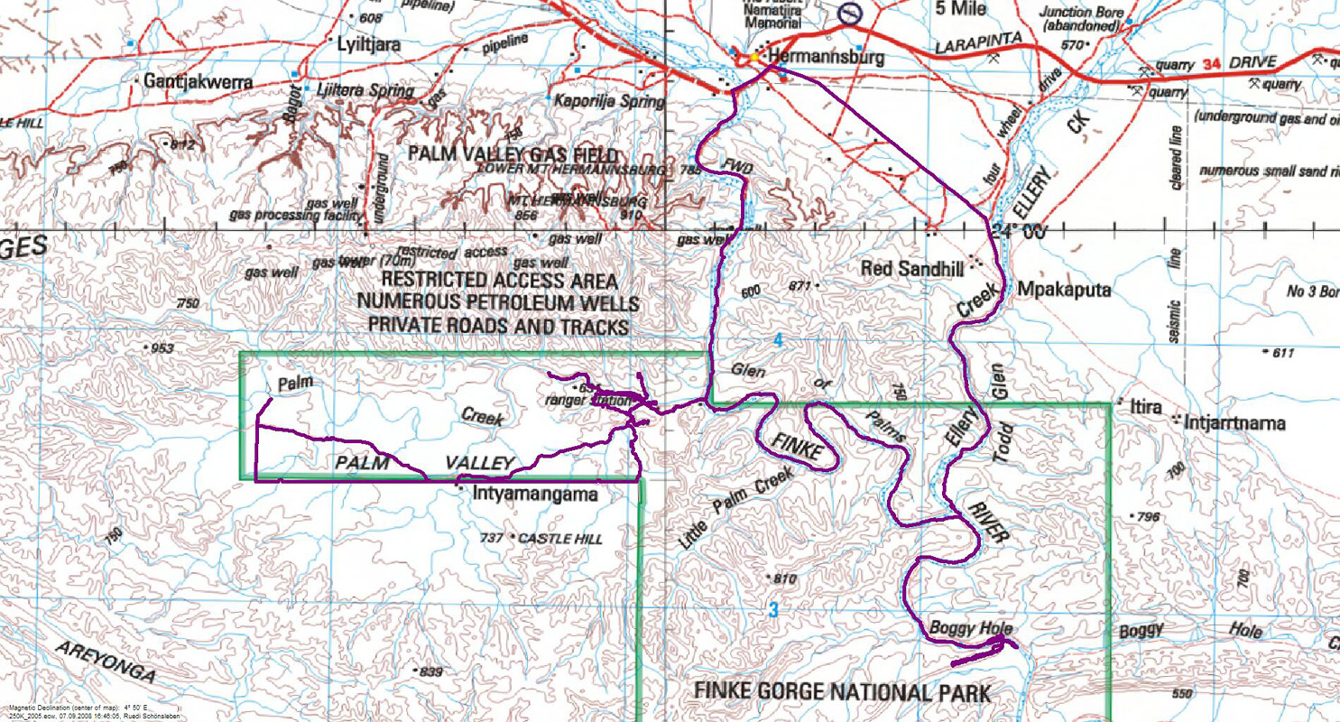
We work as volunteers at Finke River National
Park
|
|
Leg map (click to enlarge in separate
window)
|
Finke Desert Race
Link to Journey
|
|
PDF of Journey
|
|
Date
|
June 4 - June 11, 2008
|
Leg
|
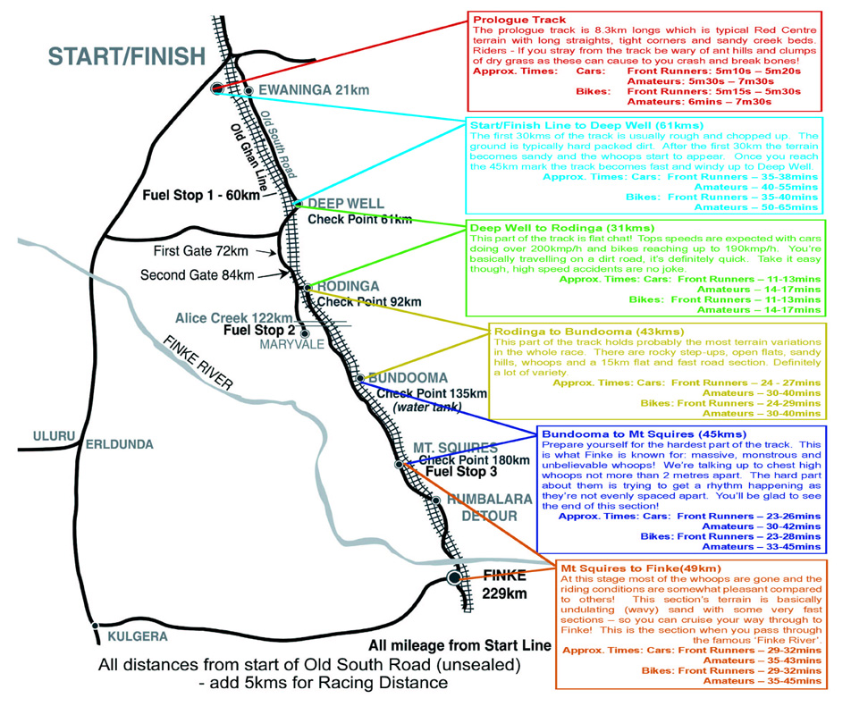
Two day off-road desert race for motorbikes, quads
and cars from Alice Springs to Finke and
back. 229
km one way
|
|
Leg map (click to enlarge in separate
window)

|
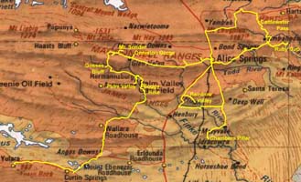
MacDonnell Ranges
Link to Journey
|
|
PDF of Journey
|
|
Date
|
May 9 - May 28, 2008
|
Leg
|
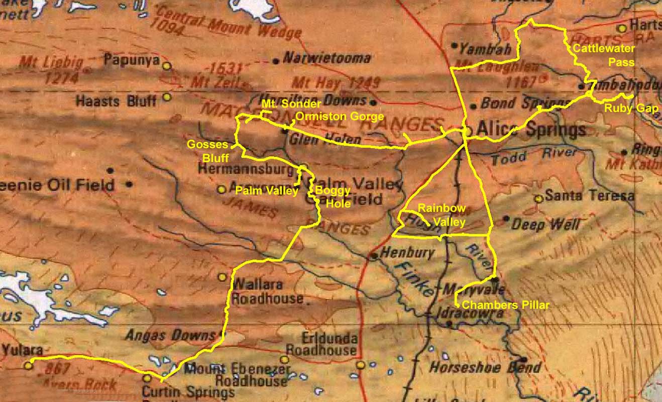
Yulara - Boggy Hole - Palm Valley - Gosses Bluff
- Ormiston Gorge - Redbank Gorge - Mt. Sonder - Roma
Gorge - Glen Helen Gorge - Ochre Pits - Ellery Creek
Big Hole - Simpsons Gap - Alice Springs - Cattlewater
Pass - Ruby Gap Nature Reserve - Arltunga - Jessie
Gap - Emily Gap - Rainbow Valley - Chambers Pillar
- Alice Springs
|
|
Leg map (click to enlarge in separate
window)
|
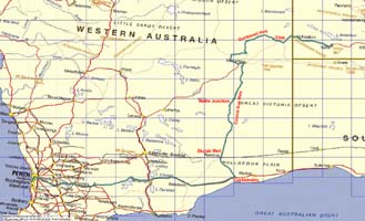
Perth - Uluru via Connie Sue
Hwy, Gunbarrel Hwy and Great Central Road
Link to Journey
|
|
PDF of Journey
|
|
Date
|
April 24 - May 7, 2008
|
Leg
|
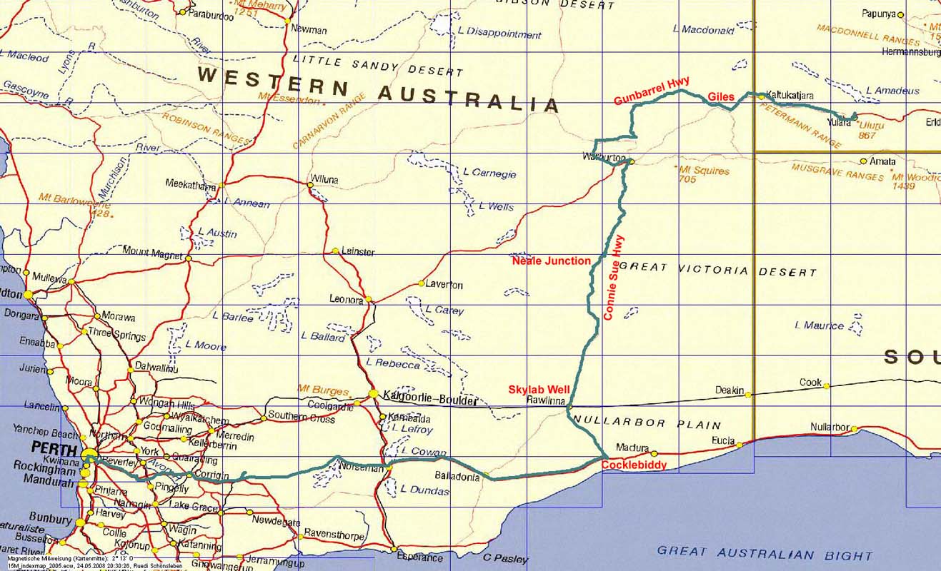
Perth - Boyagin Rock - Hyden - Norseman - Cocklebiddy
- Rawlinna - Neale Junction Nature Reserve - Connie
Sue Heather - Warburton - Heather Highway - Old Gunbarrel
Highway (abandoned section) - Giles Meteorological
Station - Great Central Road - Yulara
|
|
Leg map (click to enlarge in separate
window)
|
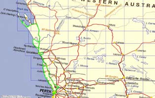
West Australia's South West
Link to Journey
|
|
PDF of Journey
|
|
Date
|
February 22 - March 27, 2008
|
Leg
|
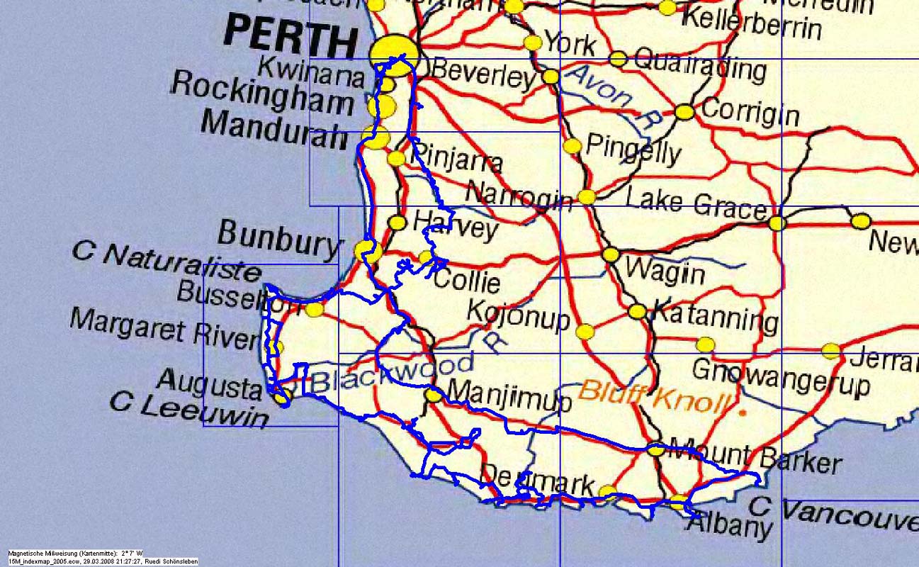
Perth - South Dandalop Dam - Dwellingup - Lane Poole
Reserve - Lake Baden-Powell - Lake Ballingall - Harris
Dam - Collie - Stockton Lake - Glen Mervyn Dam - Wellington
Dam - Wellington Weir - Collie River - Honey Moon Pool
- Donnybrook - Busselton - Forest Beach - Dunsborough
- Meelup Beach - Cape Naturaliste - Yallingup - Conto
NP - Margaret River - Cowaramup - Giant Caves - Augusta
- Blackwood River - Scott NP - Gingilup Swamps Nature
Reserve - D'Entrecasteaux NP - Jasper Beach - Lake
Wilson - Lake Smith - Beedelup Falls - Warren NP -
Northcliffe - Shanon NP - Pt. D'Entrecasteuax - Gardner
Beach - West Cliff Point - Walpole - Mandalay Beach
- Long Point - Mt. Frankland NP - Valley of the Giants
- Conspicuous Beach - Peaceful Bay - Parry Beach -
William Bay NP - Denmark - West Cape Howe NP - Albany
- Waychinicup NP - Porongurup Ranges - Mt. Barker -
Rocky Gully - Manjimup - Nannup - Ballinup - Donnybrook
- Bunbury - Leschenault Peninsula Cons. Park - Perth
|
|
Leg map (click to enlarge in separate
window)

|
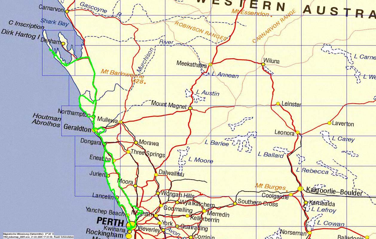
Perth - Steep Point - Perth
Link to Journey
|
|
PDF of Journey
|
|
Date
|
January 21 - February 10, 2008
|
Leg
|
Perth - Moondyne Nature Reserve- Brandt Highway -
Dongara - Ellendale Pool - North West Coastal Highway
- Shark Bay - Useless Loop Road - Tamala Station -
Zuytdorp Cliffs - the most westerly point of mainland
Australia - Steep Point - Thunder Bay - False Entrance
- Murchison River - Geraldine Lead Mines - Kalbarri
- Lucky Bay - Hutt Lagoon - Horrocks - Northampton
- Coronation Beach - Geraldton - Dongara - Carsons
Beach - Lake Indoon - Leeman - Green Head - Sandy Point
Nature Reserve - Jurien Bay - Hill River Mouth - Cervantes
- Pinnacles - Grey - Wedge - Lancelin - Ledge Point
- Seabird - Guilderton - Perth
|
|
Leg map (click to enlarge in separate
window)
|
top
-
home
|