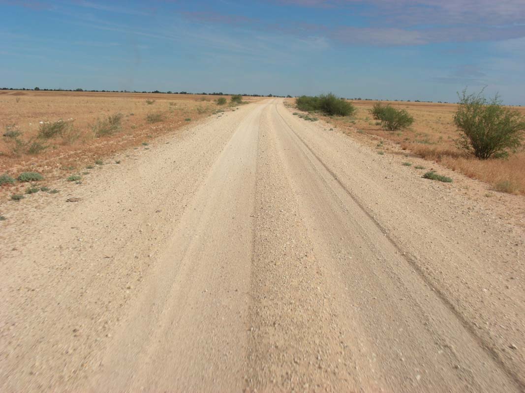
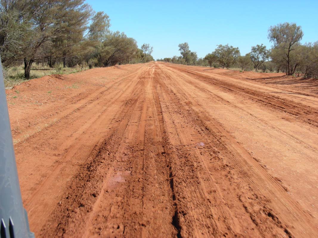
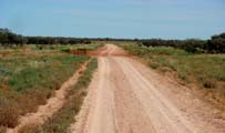
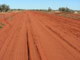
On Sunday May 13th 2007 we leave Kooroorinya hitting
the dirt again.
We travel south-west towards Winton, all
on small tracks across stations.
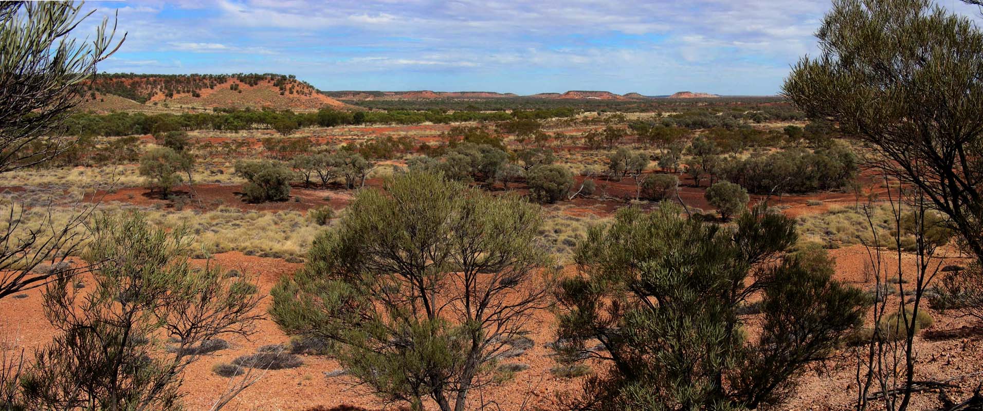
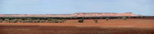
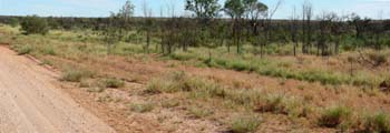
After a while the hills disappear and
the country gets flat ... and we mean flat.
It is flat as far as
the
eye
can
see; the
view is not obstructed by many trees.
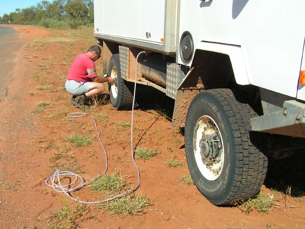
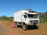
Ruedi notices that the front right break does not break
correctly.
The OKA pulls to the
left side making breaking quite difficult.
The risk of overturning the vehicle has to be
taken into consideration when applying the breaks.
This will have to be checked in Alice Springs.
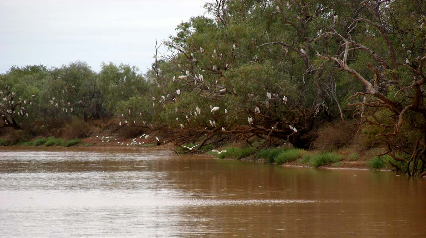
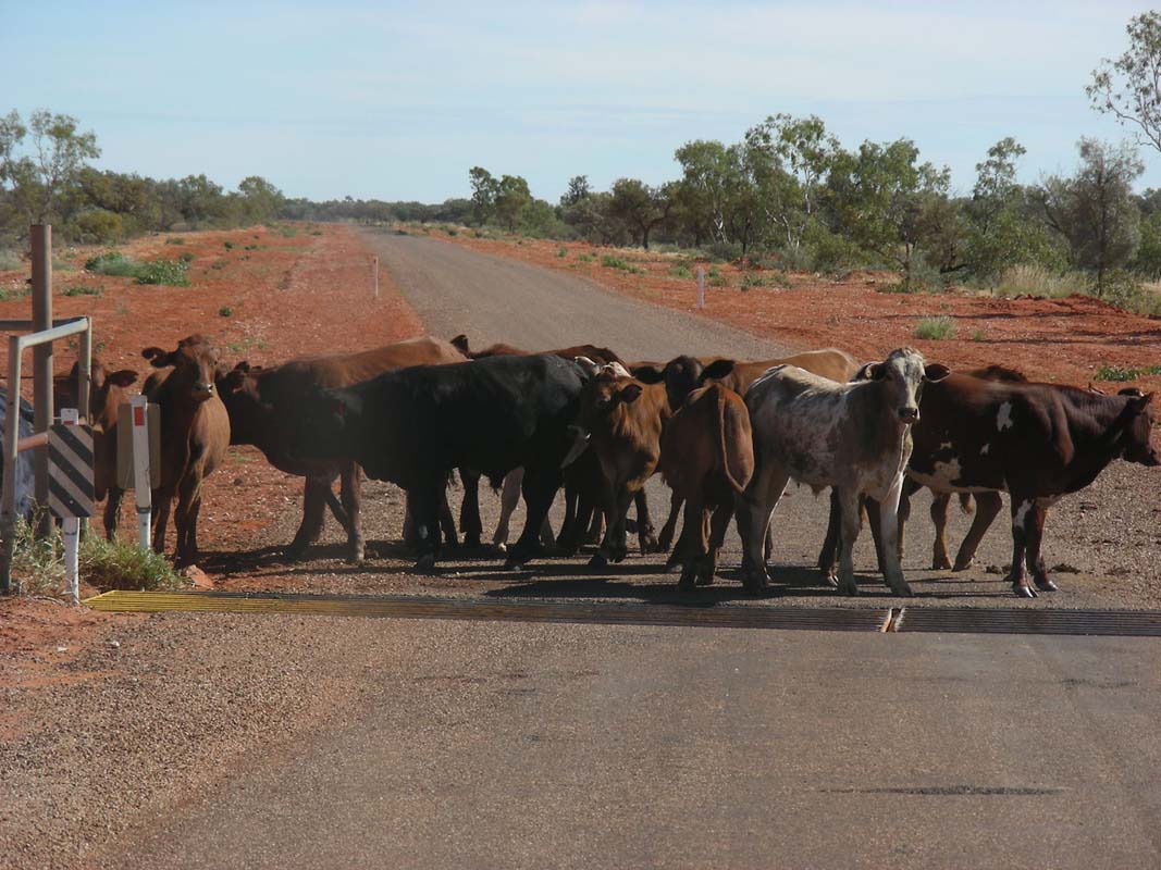
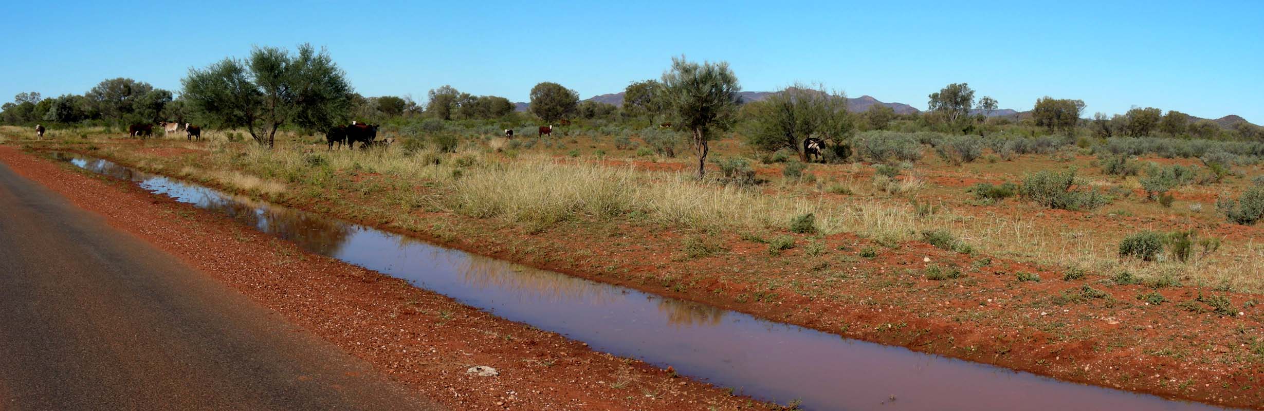
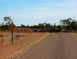
We see many young calves; the Brahman must be having their
young.
We pass a cow where the calf must be just a few minutes
old, just trying to get up the first time. The ground is
still wet from the birth.
There are also many lambs around.
This is the first time we see sheep and cattle in the same
paddock.
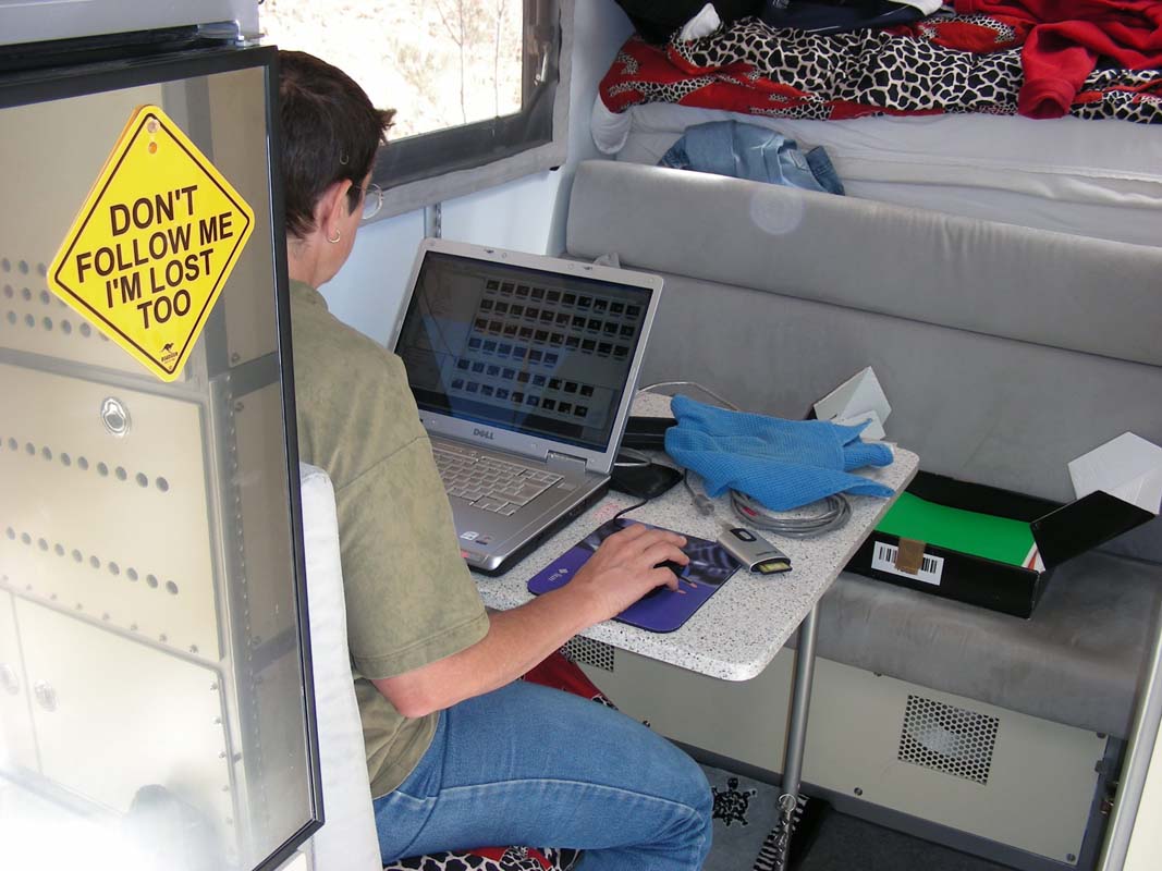
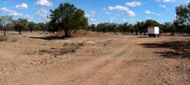
We camp a bit outside of Winton.
We are pleased to find Internet access with our NextG
modem.
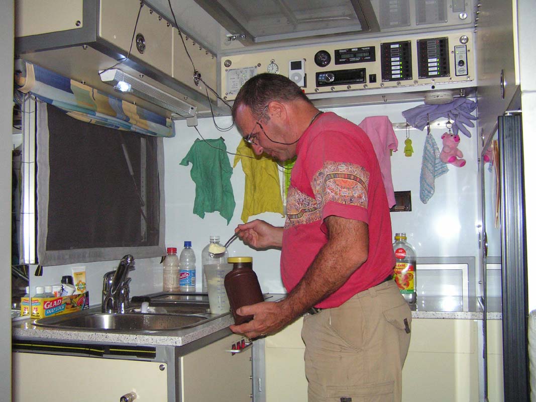
As we have been on the road already for so many days without
having had a chance to stock up on fresh produce we run out
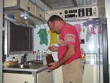
of Ruedi's favourite drink: fresh milk!
But he has become a master in preparing "fresh" milk from
powder milk.
Actually we like the milk from powder milk better than the
long-life milk.
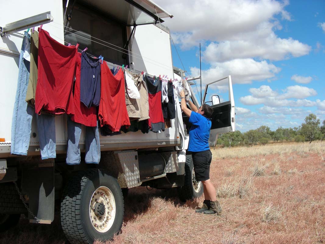
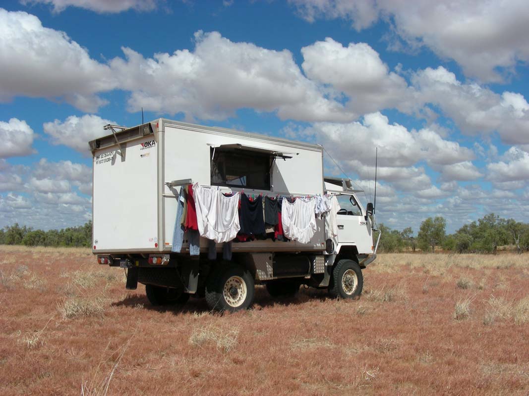
On Monday morning we head into town
to do the washing. As the machine only takes one-dollar coins
we run out of coins
halfway
through drying the clothes.
The post office has no one-dollar coins
to share, the bank has already closed so we have no other choice
than to take the wet clothe along, drive out of town and set
up the clothe line along the OKA.
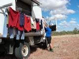

With an outside temperature of close to 34°C, only
40% humidity and a light breeze Mother Nature takes care
of it in no time.
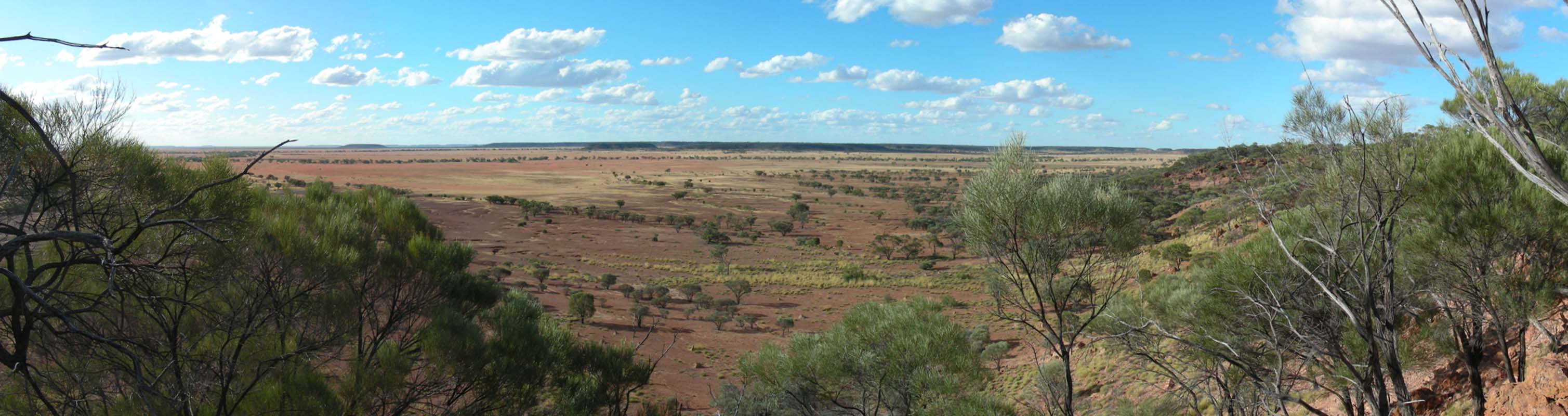
After lunch we head off into the Bladensburg
National Park and stop at the old homestead to get information.
The ranger
explains that this park is special because it is at the border
between the flat Mitchell grass plains and the mountains.
It is the home of the endangered Julia Creek Dunnart, a mouse-like
marsupial.


The ranger also gives us the tip to visit the Scrammy
Lookout.
The story goes that boundary riders sometimes became hermits,
known as “hatters”.
One of these hatters was Scrammy
Jack, so named after his right hand was crushed by a wagon
wheel.
"Scrammy" in an old English term means “left-handed”.
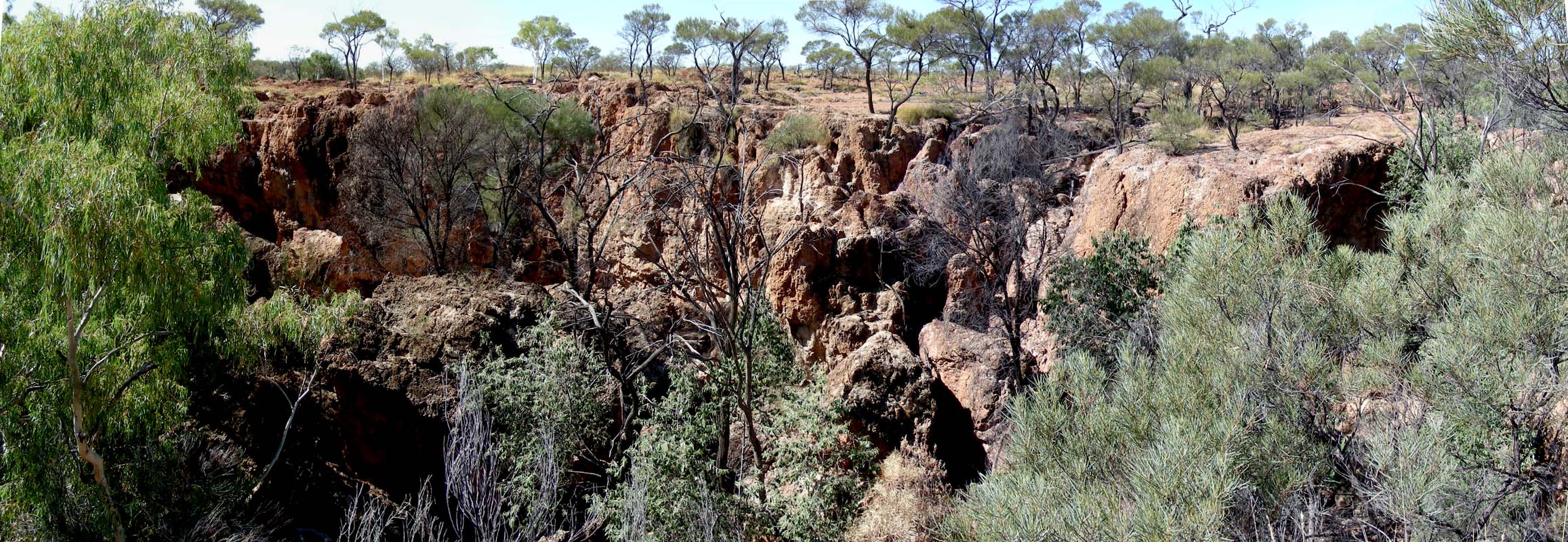
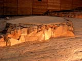
We leave the park and camp outside in a quarry.
After a warm night with 20.6°C we
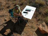
have a busy Tuesday morning, Susi working on the pictures,
Ruedi fighting with the grease
gun … #!"&?*$%

After lunch we
continue through the Bladensburg NP and stop
at the Logan Falls.
With water they must be quite a sight,
but in the drought it is all left up to our imagination.
Well, the dragon doesn't seem to mind the dry weather ...
We turn right after the park onto the Nareen – Jump-up
Road only to find a gate with some very clear signs that
this is a private road. Strange.
We have been told that all roads
in the Hema maps that are not explicitly marked with “private
road” are maintained by the council and therefore
are accessible to the public.
The road through Colston Station
is in the Hema Road Atlas and not marked.
But as we don't want
to be involved in nasty arguments we turn around and continue
travelling south on our track.
(Note: on the “Great Desert Tracks” map we later
on see that the road really is marked as “private”
… ah well, sometimes we should change to the more detailed maps a bit
earlier ...)
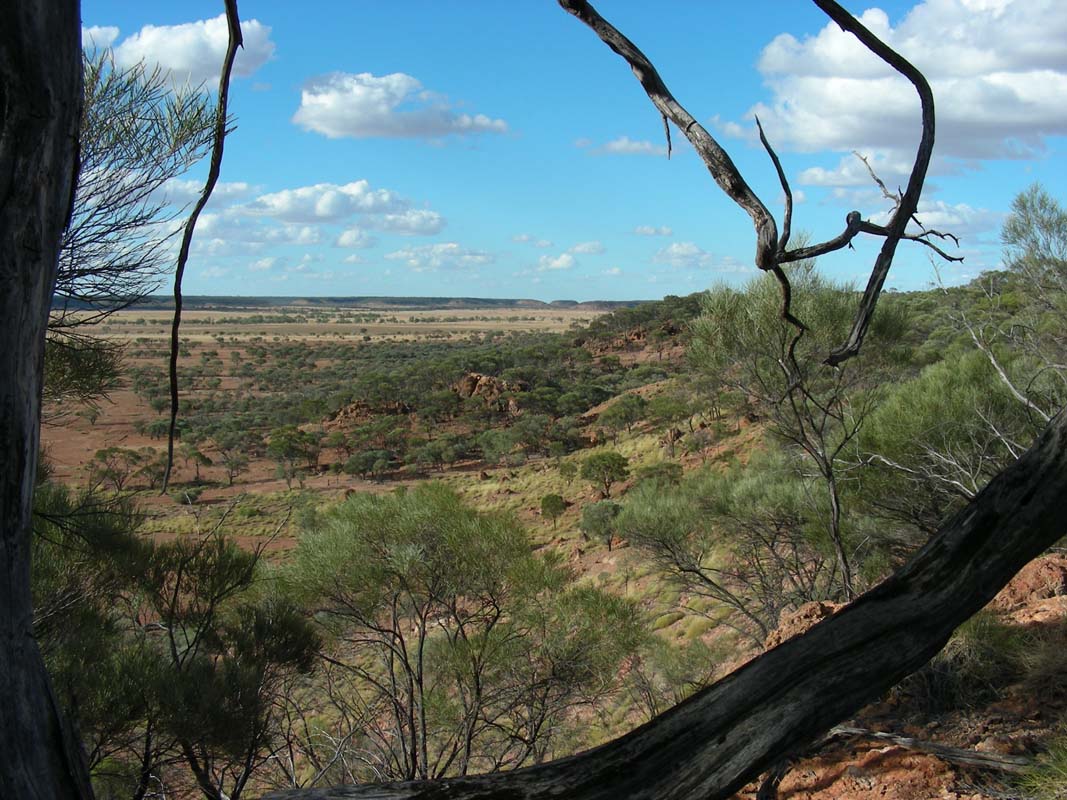
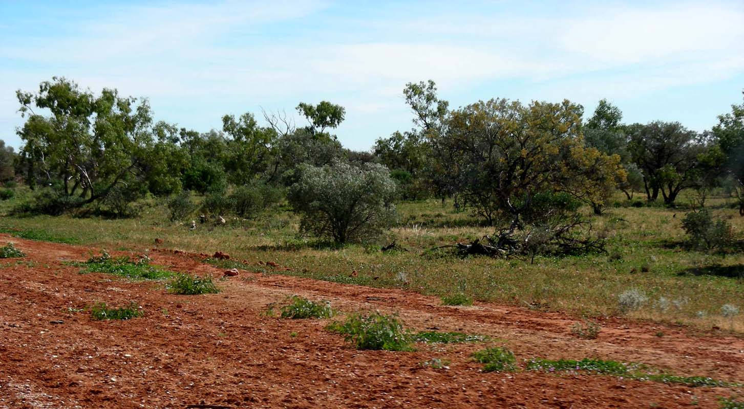
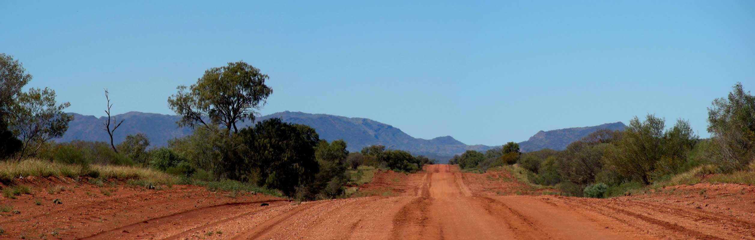
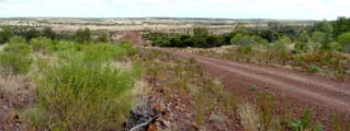
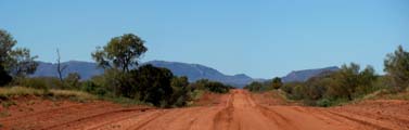
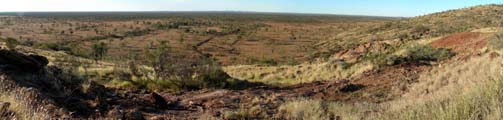
Leaving the Allen Range behind us the county
again is flat, endlessly flat; it just disappears into the heat reflecting
from the ground.
Only some trees, some
cattle and every so often a gate or grid change the scenery.
We see some Wedge-tail Eagles flying in circles.
There
are not too many eagles left in this section of Queensland, as they used
to
be
hunted.
At times
there had even a bounty been placed on their claws.
The farmers told us that the
eagles actually steal lams.
They
take the lambs up in the air and drop them
to the ground
to kill them.
As the lambs bounce of the ground the eagles pick them up again in
flight and take them to their nest.
They need 2 lambs a day to raise their young … some farmers say
they have even seen eagles taking freshly born calves away … we
doubt a bit.
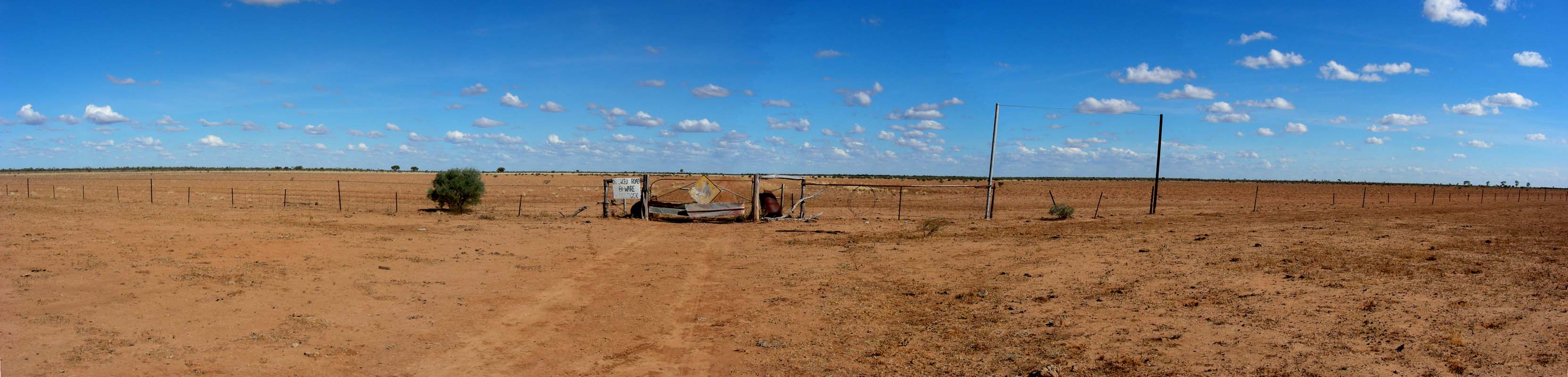
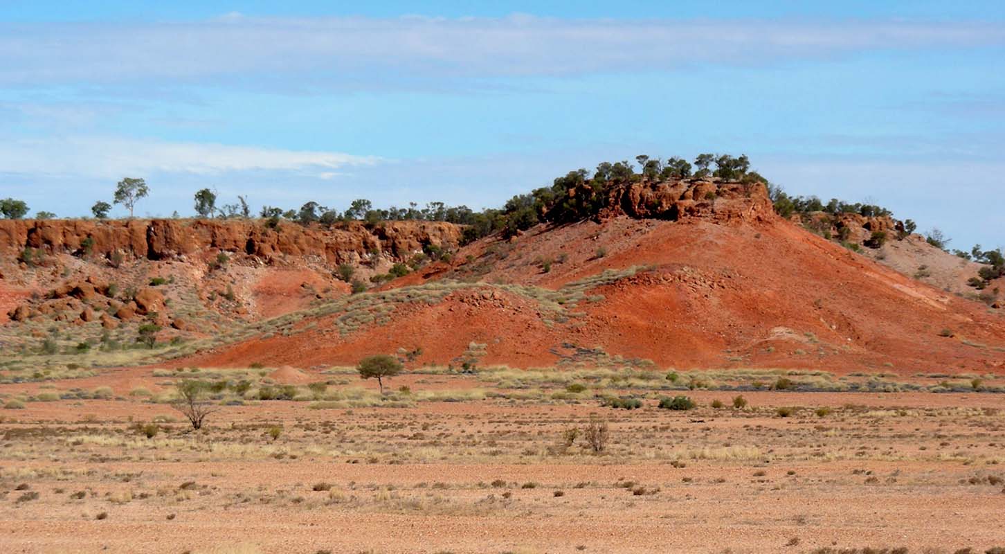
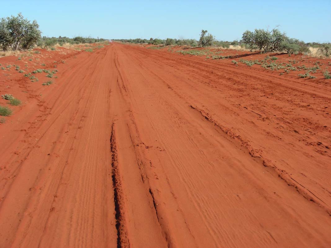
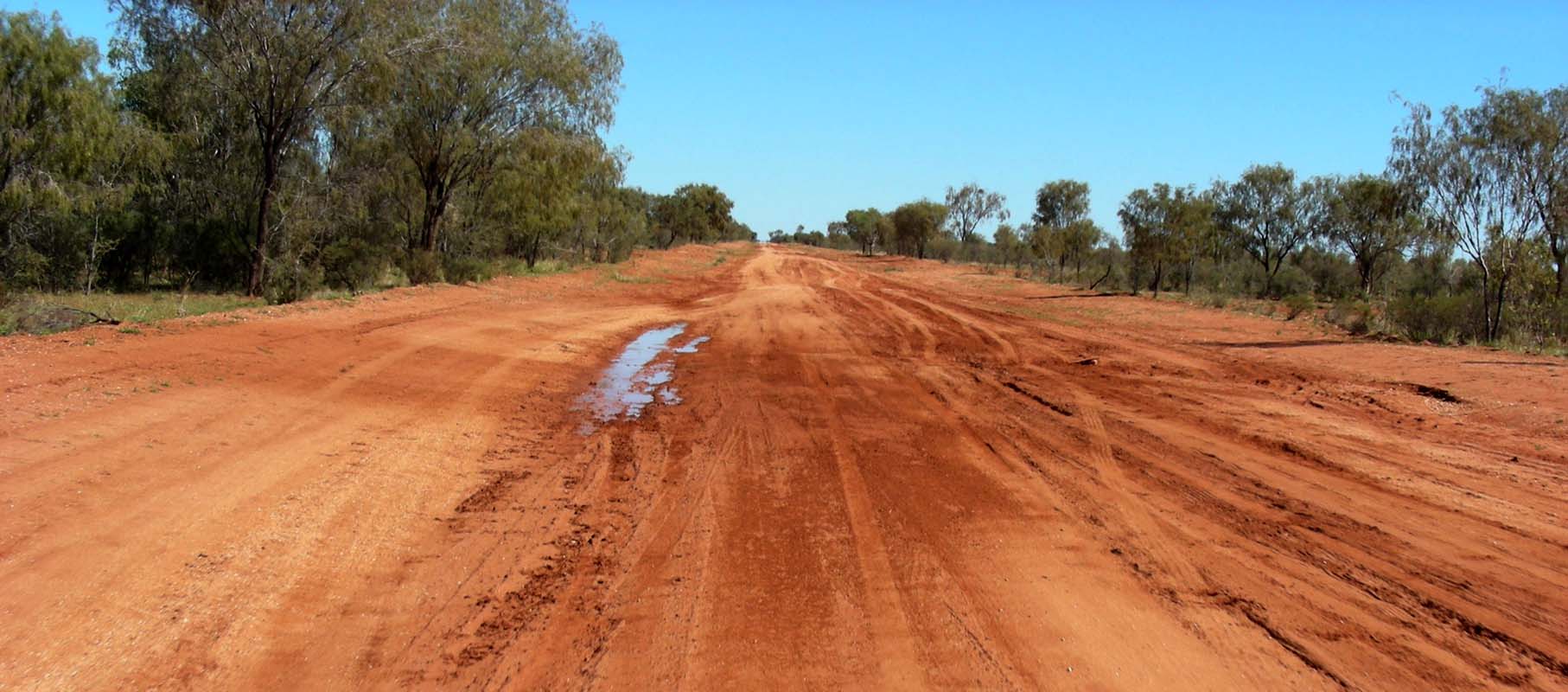
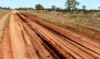
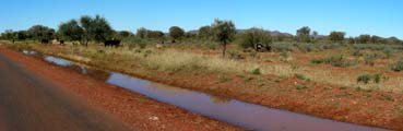
We turn right into an official Stock Route and head north-west.
The country
changes to red
soil and a good growth of various sorts of trees.
It looks like some of the creeks have caused trouble to passers-by
previously during the wet season.
This creek passage has a "flood-bypass" made of logs.
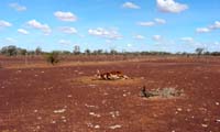
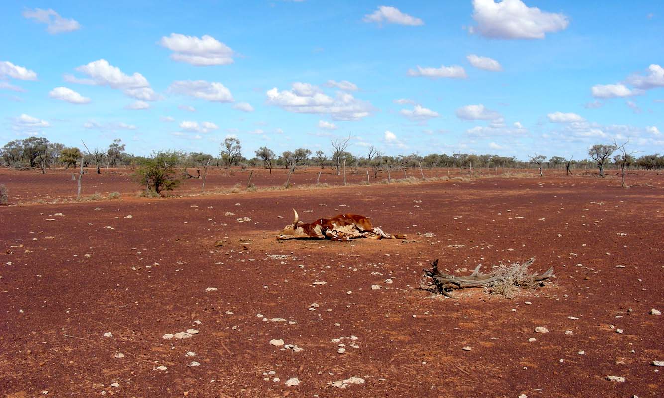
Every so often we pass areas where nothing seems to grow; even the
trees are dead and dry.
Here we find a cow that did not make it.
This happens
when cattle
are shifted to another paddock and the gates closed behind them.
If not all make it through the gate on time the ones left behind
will die of thirst.
The
cow has not even decomposed, just dried out in the scorching sun …
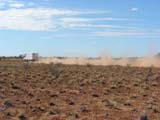
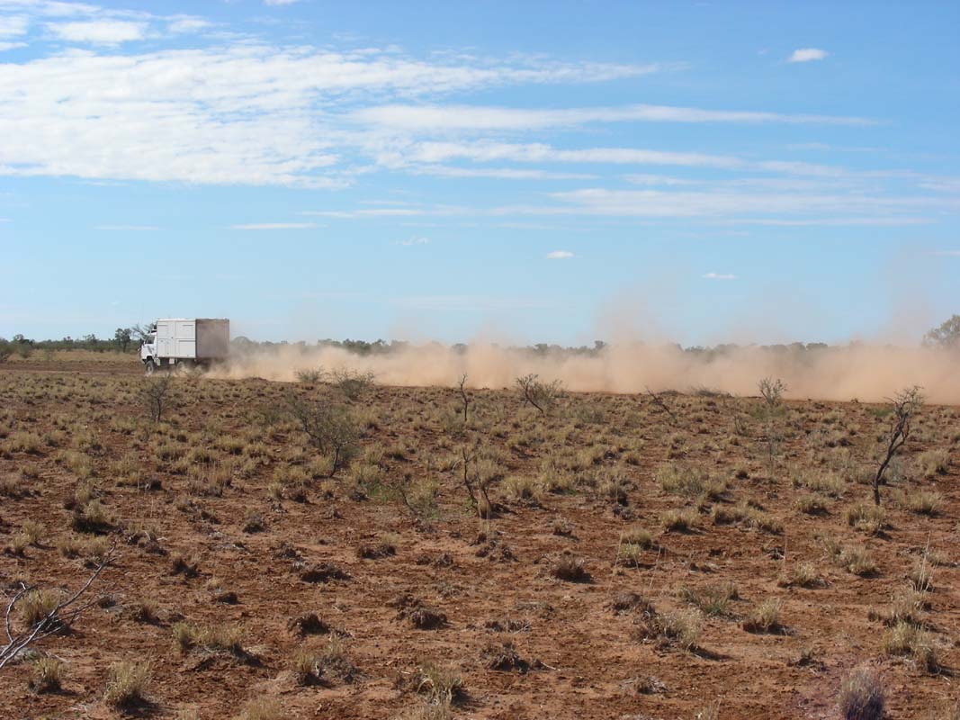
We also learn that on dusty roads, if the wind comes from behind
you (and even if it is just
a soft breeze …) when you approach
a closed gate you better wind up the windows and wait inside the
cabin until the dust cloud has passed you.
Otherwise you and the
interior of the cabin will be dusted with very fine red sand…
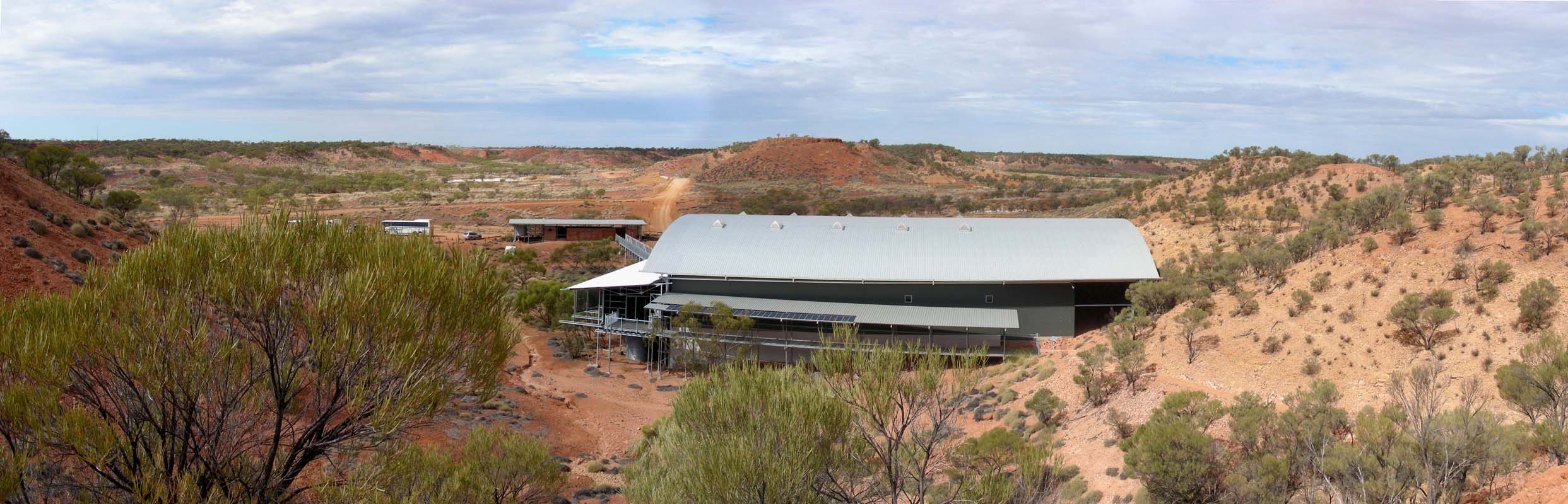
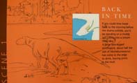
Reaching the Winton – Jundah Road we head south
towards the Tully Range, the home of the Lark Quarry Conservation Park,
where we want to visit the famous
dinosaur stampede.
We camp just round the corner of the turn-off.
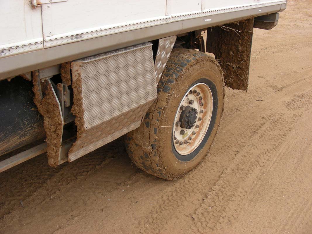
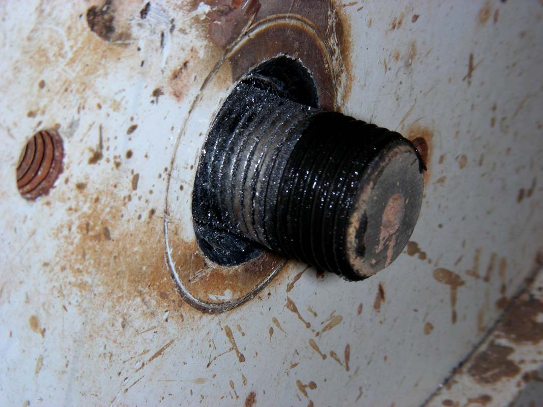
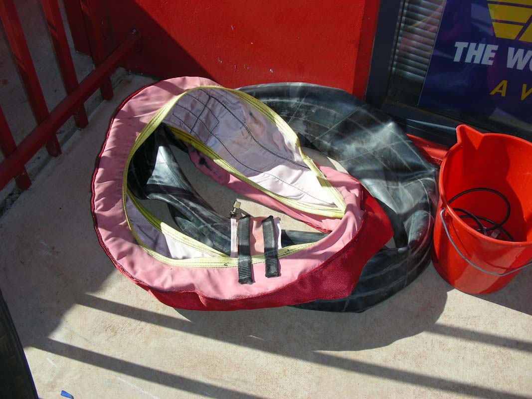
Ruedi is busy
modifying the battery caps. The caps have to pass on the battery
gas to poly-pipes so the gas can be brought outside of the
dust tight battery compartment.
Aluminium has not proven to be a good
material
as it corrugates
with
the acidic fumes. Some kind of a sublimate
is formed
clogging up the tubes forcing the gas to escapes into the
closed compartment.
In the worst case a spark
could blow up the whole battery as there are fans running
close by.
So Ruedi is replacing them with
brass fittings.
As
the Sikka he is using to glue them in has to dry he leaves
the hatch open over night.
The clouds still hang around and it is a warm and muggy night,
still 29°C
at 9 PM.
As it has to come (else we would not have written the whole
story), in the middle of the night we wake up to rain-drops
falling onto
the
roof
of
the
camper …
Ruedi rushes out into the light rain and
mounts all the fittings back onto the batteries so he can close
the hatch door.
A few more drops fall and that's it with rain for the
night …
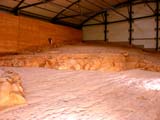
In the morning we continue to Lark
Quarry Conservation Park
. return to top


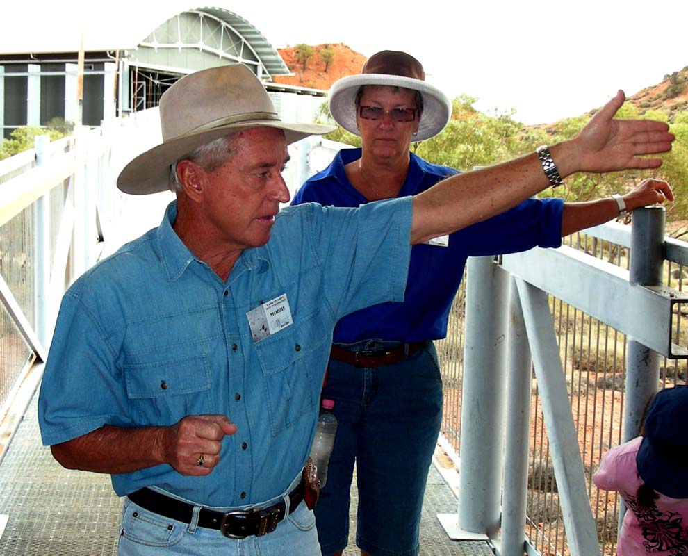
We get greeted by "Mozzie" and Margaret, our guides
through the park.
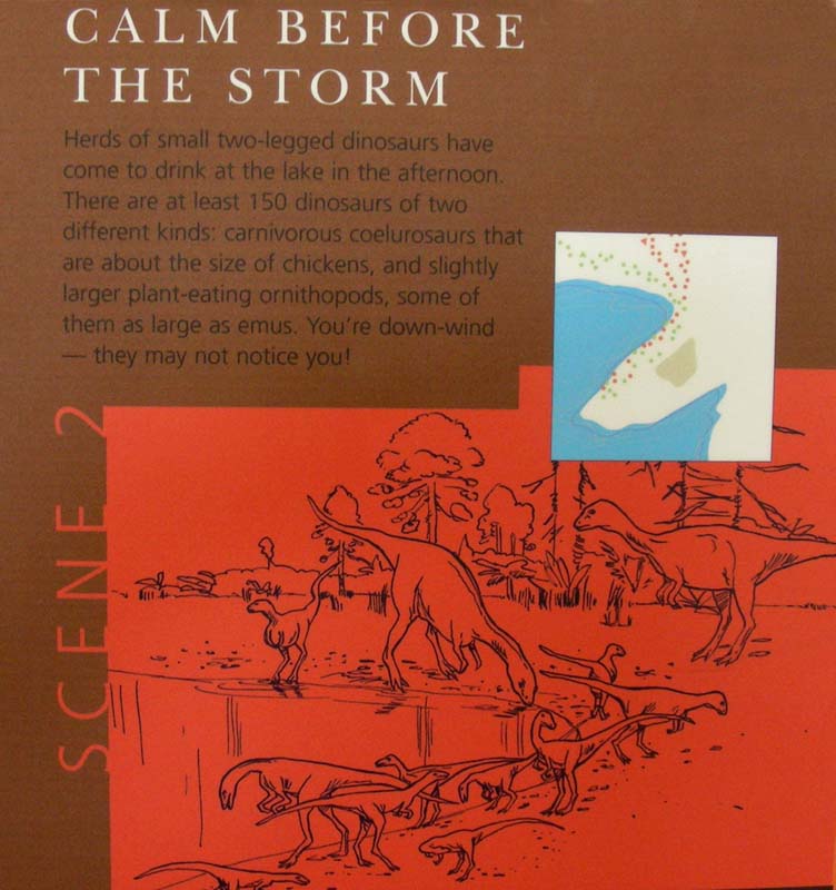
The explanation we get is that around 95 million
years ago, a large herd of small two-legged dinosaurs gathered
on the
banks
of a
forest
lake
to drink.
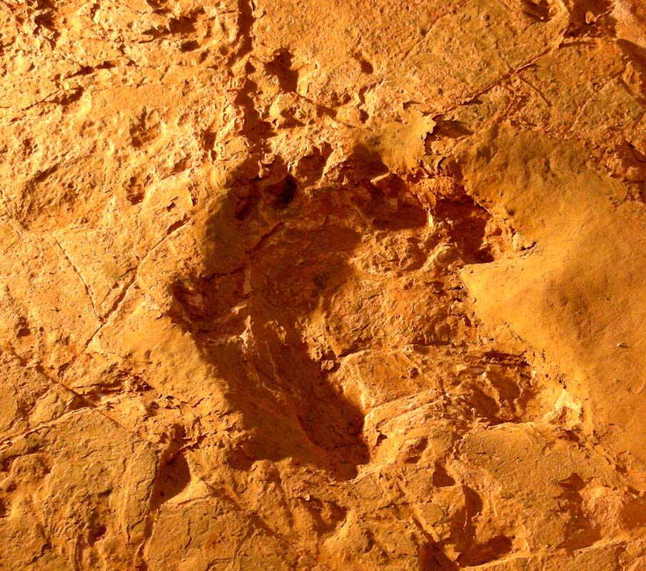
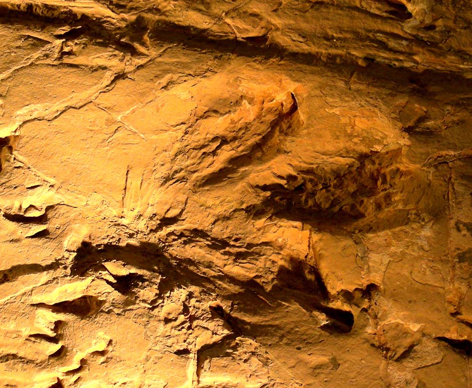
The herd was stalked by a large theropod - 4 tonnes of sharp-clawed,
toothy, meat-eating dinosaur - panicked and stampeding
across the muddy flats.
The mud hardened preserving the tracks.
The lake slowly rose
covering the tracks with the next flood.
Thousands of
years sediments laid
down forming rock over millions of years.

And then the world changed, dinosaurs disappeared, the
once lush lake now is a dry
mountain range.
Rain runoff stripped away the rocks forming gullies, mesas,
hard topped escarpments.

In the 1960s Winton grazier Glen Seymour
showed local expert Peter Knowles what he thought were fossilised
bird tracks
found at this site.
Glen thought Peter was "pulling
his leg" when Peter told him they were dinosaur tracks.
In 1971 scientists from the Queensland Museum and British
Museum of Natural History were in the region looking for
Cretaceous mammals.
Knowing Peter's interest in fossils,
they approached him.
He couldn't help them with mammals
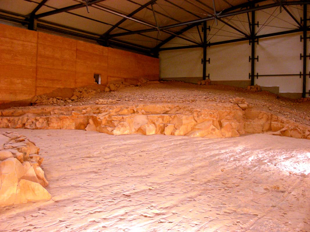
but showed them Lark Quarry and the dinosaur tracks.
At the quarry the scientists traced the sediment layer
the tracks were found in across to a second hill farther
west.
They predicted there would be more tracks at the same level
and were right.
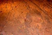
In 1976-77 a team of volunteers led
by Queensland Museum and the University of Queensland's palaeontologists
spent
18
months removing part of the hill to expose the trackways
layer of the only known dinosaur stampede on earth.
The
site was very remote, the road a mere track and camping
conditions
tough.
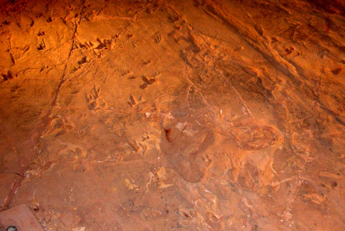
Vital statistics
Removed: 60 tonnes rock
Area: 210 sq m
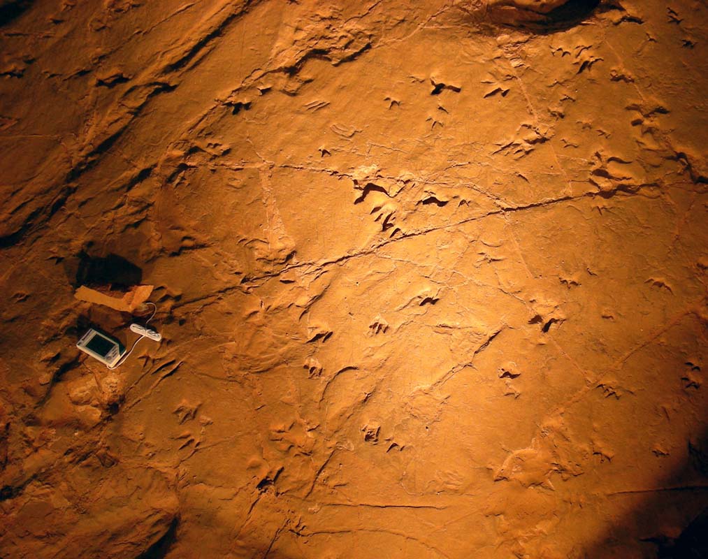
Cleaned, photographed, moulds cast: 3'300 footprints
Heat, cold, water wildlife,
careless visitors take their toll on fragile tracks ....
To prevent further erosion the tracks were covered with a roof resulting in
wildlife moving under the roof into the shade during the day, damaging the
tracks further by
walking
over
them and leaving their excrements.
So they covered the tracks with hay and plastic foil. The hay got humid,
self-ignited and damaged some of the tracks.
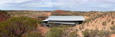
They applied for a grant and since 2002 a new building
powered by solar cells conserves the panic and
pandemonium of one ordinary day
at
a lake 95
million ago.
A record of those few terrifying minutes is cast in more than 3300 fossilised
footprints conserved in the Trackways building.
It tells us much about that cooler, wetter world, when dinosaurs were still
in charge and the mammals' time was yet to come.
There are still many footprints hidden under the original
rock.
They
left it that way on purpose just in case and for what ever
reason the already exposed footprints should get damaged
further.
The sandstone is so fragile that the temperature and humidity in the Trackways
building is kept at the same levels all year round.

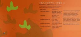
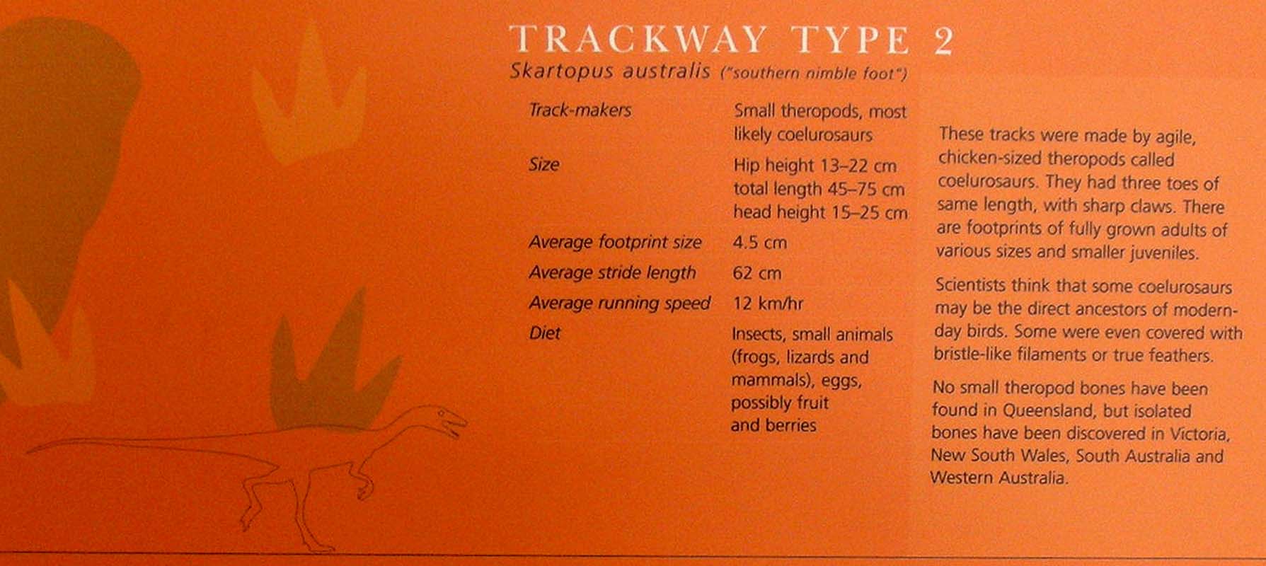
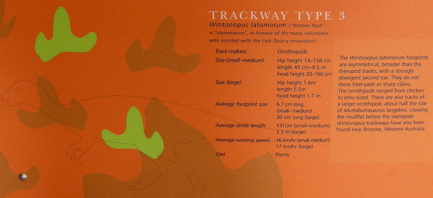
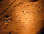
Over the next few years, back in Queensland Museum's labs,
each print was measured and described.
Where individual trackways
could be followed, pace length, stride length and pace angulation
were measured.
All up, 150 individual dinosaur trackways
were mapped.
Dinosaur skeletons from all over the world with feet roughly
matching the Lark Quarry tracks were examined to identify
the trackmakers.
The dinosaurs' running speeds were then
worked out using equations based on locomotion of living
animals, incorporating size, weight and flexibility differences.
Once
the scientists knew dinosaurs made the tracks, how many there
were and how fast they moving, they were able
to figure
out what actually happened here.

How do they know it
was a stampede?
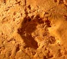

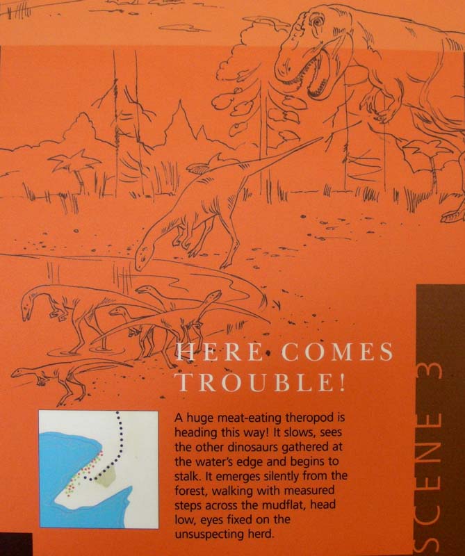
The big theropod's tracks initially show it walking
across the mudflat with slow, measured steps.
Suddenly it turns
and charges towards the shore.
This suggests it saw
the herd of smaller dinosaurs by the water's edge and
tried to
head them off.
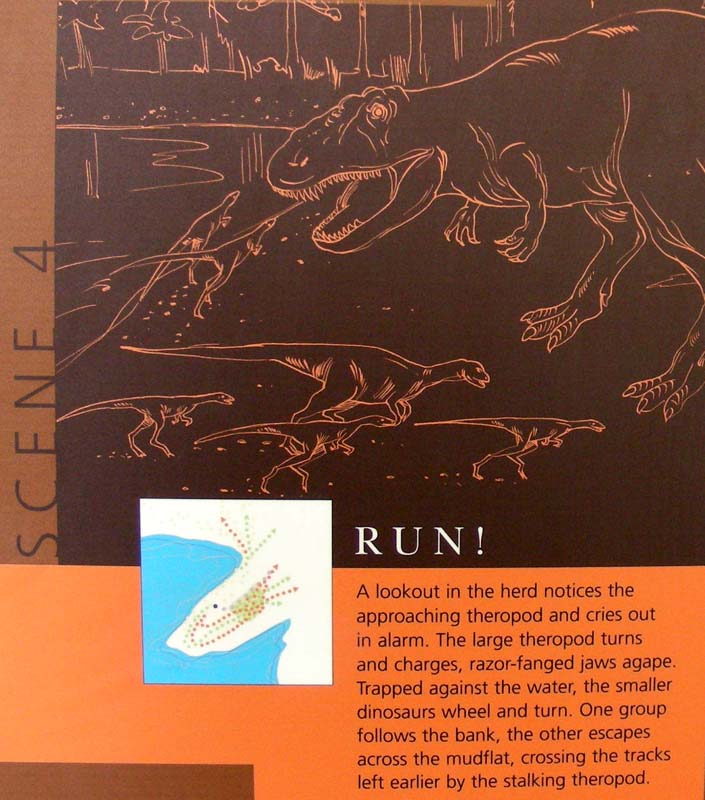
The little dinosaurs all ran in the same
direction at the same time, 55 degrees east-north-east
back across the mudflat,
their tracks crossing those left early by the theropod.
It is a good guess that they stampeded to get away.
Was one caught in the lake shallows?
We can't tell because
the lake edge has eroded away. But we do know the
others kept running for dear life.

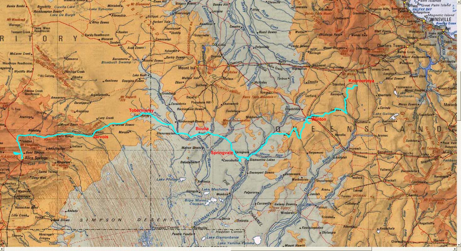
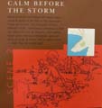
We continue travelling westwards and take the Cork – Jundah
Road towards
the Diamantina.
The view
of the Tully Range is beautiful.
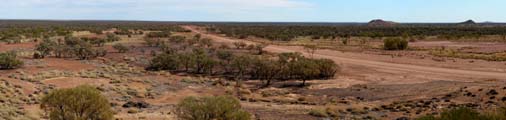
Then the country gets flat
again.
There is no feed
left on the paddocks, all grass has been eaten down to the
ground by cattle and sheep …
The Muellers Ranges shows well, how the area
gets eroded.
Shortly before Old Cork we sight the first
sand dunes.
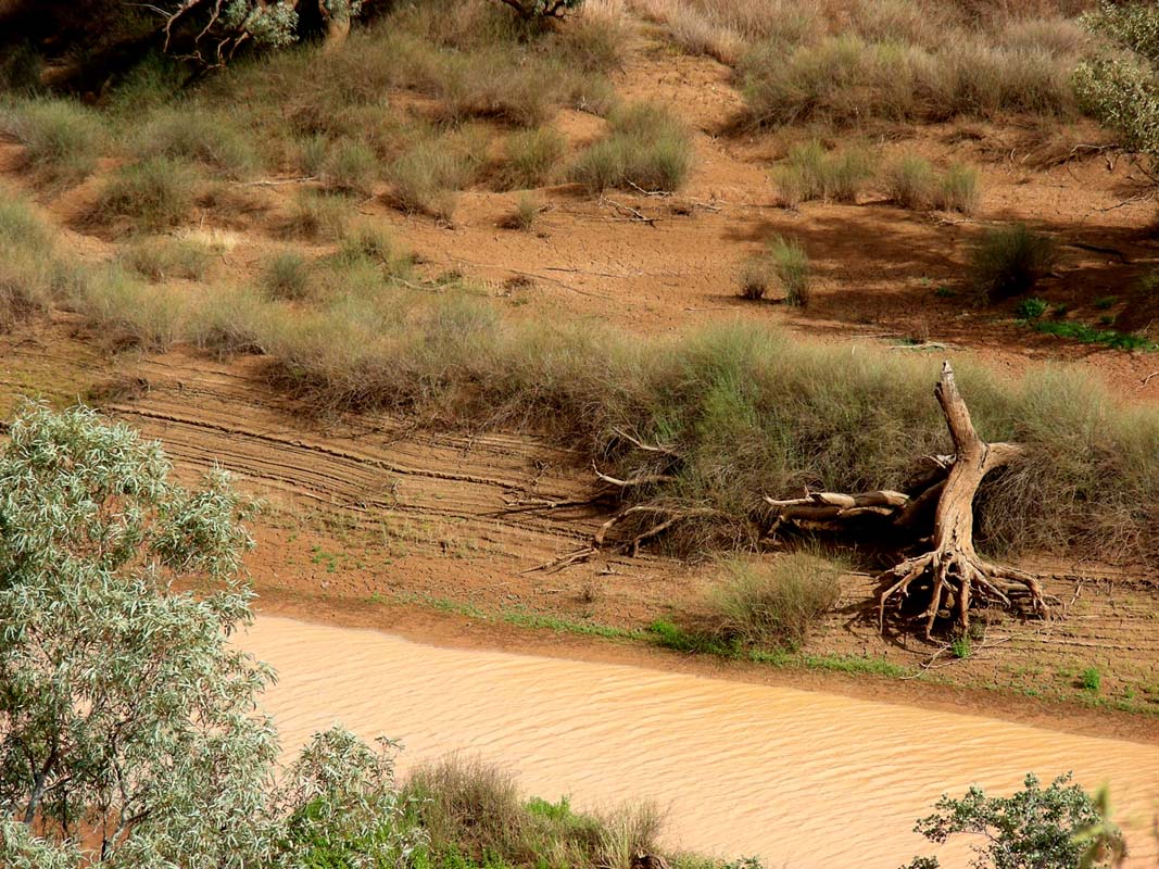
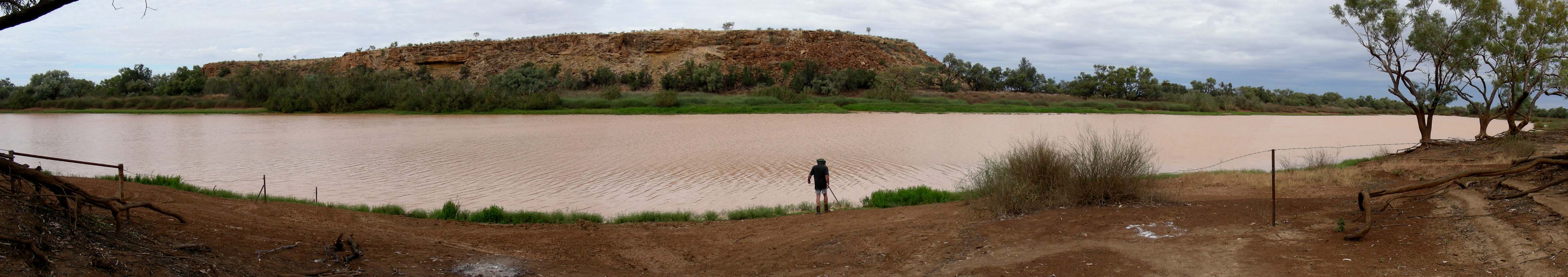
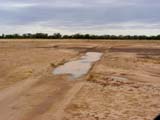
The river bed of the Diamantina River is
wide.
We try to imagine how it must look when there is water
flowing here … impressive
would be the right word for it.
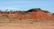
The Nisbet
Range is eye-catching with the red and white flanks
of the hills.
The Mayne Range has some interesting formations,
real mesas (mesa in Spanish means table).
We find our selves a quiet little corner just outside the Diamantina National
Park and stay over night.
There are zillions of extremely friendly
flies ….
The breeze dies down and making the night a muggy one (22.6°C
before sunrise).
On Thursday morning some rain clouds are
hanging around; they forecast scattered
showers for the area ....
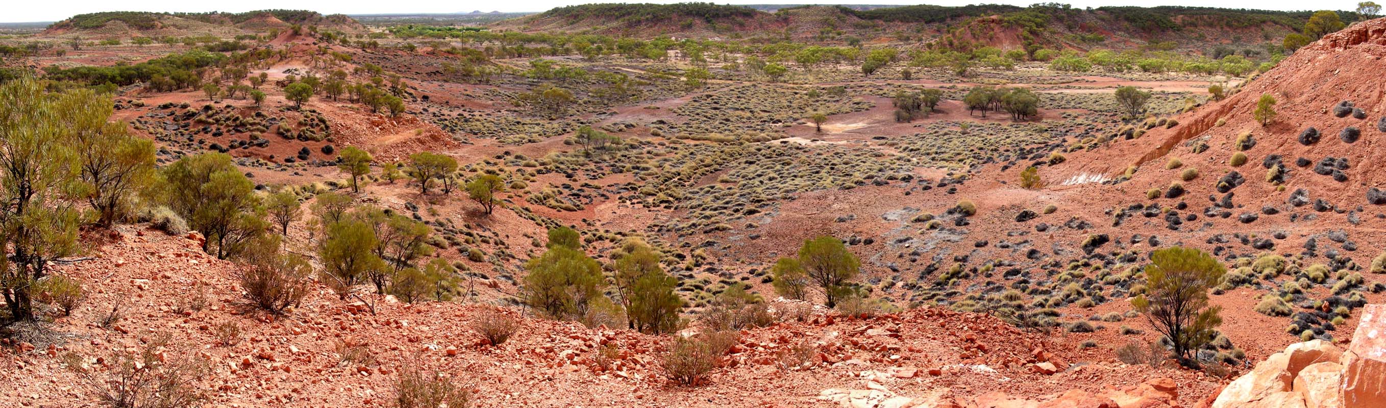
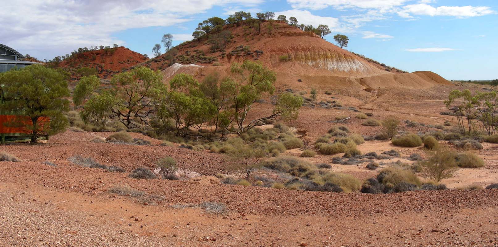
We drive through the Mayne range into the Diamantina National Park.
The hills of the range soon give
way to flat, sandy and dry planes.
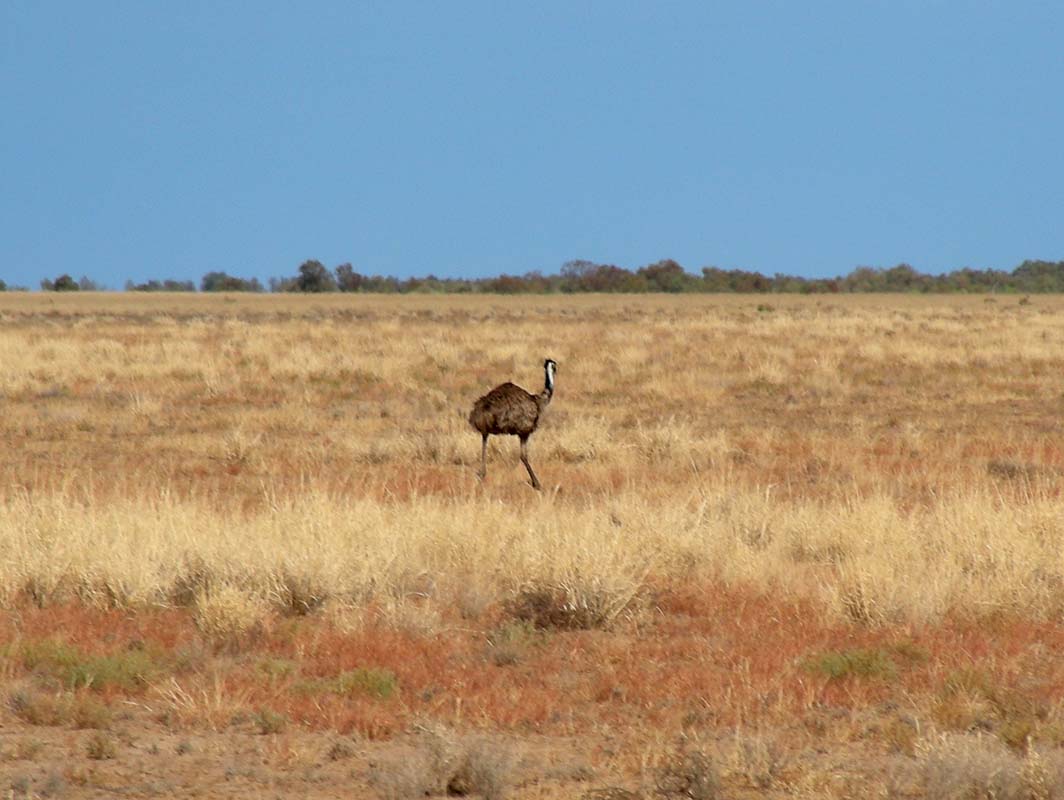
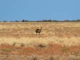
We see some emus.
Wild animals have a bad habit of trying to
cut across a moving vehicle in front of it.
This emu also wants to do that and runs along the OKA. Increasing our speed
would increase the risk of having the emu go for a mad dash across the
truck
and
us hitting
it.
So we reduce the speed and drive behind it for a fair while until it makes
up its mind and as predicted crosses the road.
You can't rush wildlife ...
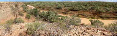


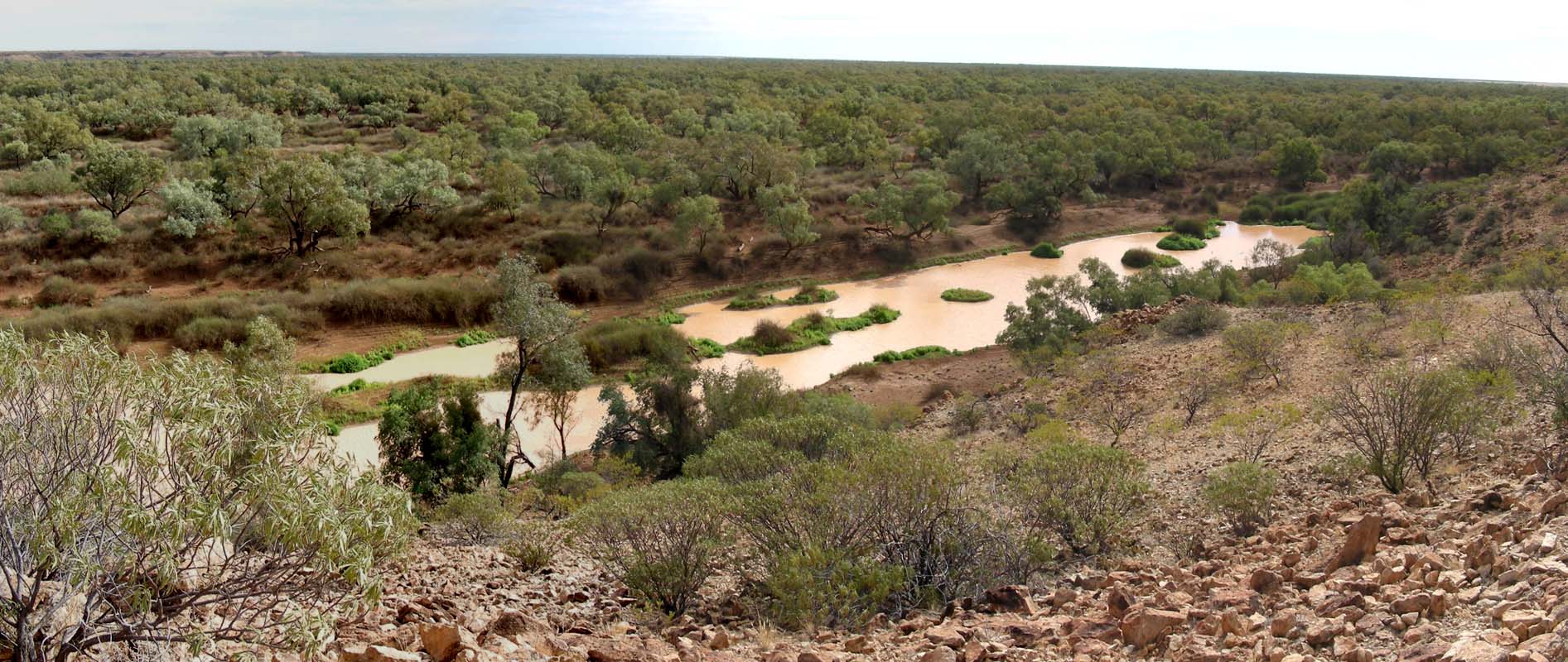
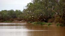
We follow the signs to Janet's Leap Lookout.
The valley below (Hunters Gorge,
Diamantina Gates) is covered with green trees and fresh grass.
The marks on the river bank clearly show how the water level is falling.

But there is still a fair bit of water left in this area of the Diamantina
River.
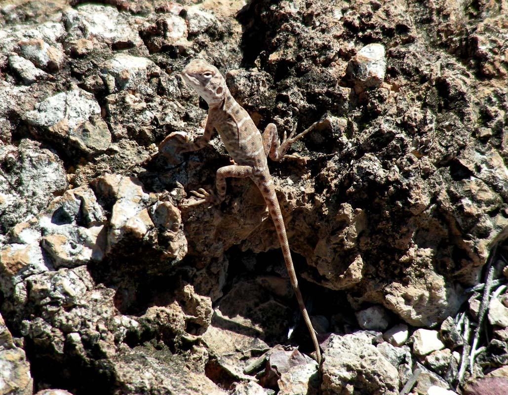
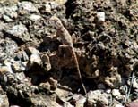
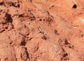
On the way back to the OKA we find this little critter .... do you see it?
Click on the picture to enlarge it as usual or Click here
to see the exact position of the animal.
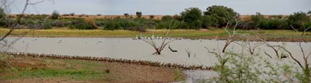
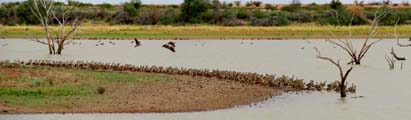
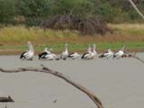
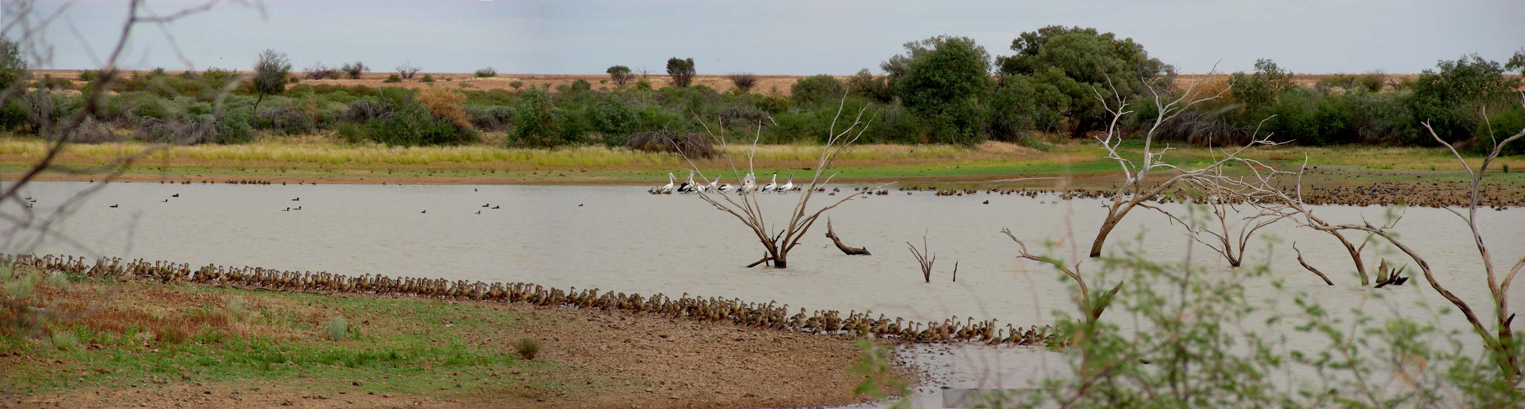
We continue on to the Green Tank Waterhole, a man-made dam, built in 1960.
There are flocks of ducks and also pelicans having a bit of a “chat” to
each other.
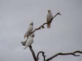
Also the next waterhole, the Warracoota Waterhole, still has lots
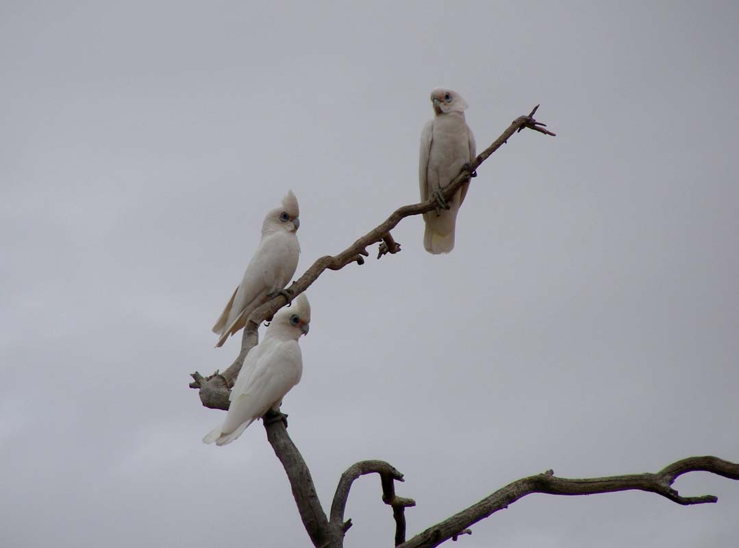
of water. Noisy white Cockatoos mark their presence.


Due to the looming rain we decide to take the same way back to
the Springvale Road and not continue any further
into the sand-dunes.
We have already
found out that this sandy track gets very sticky with just
a bit of water .....
We continue to Boulia and are surprised to see green grass.
They seem to be luckier with the amount of rain they got out here.
In Boulia we fill up fuel and food for the crossing over
to Alice Springs on the Donohue Highway (on the Queensland
side) and the Plenty
Highway (on the Northern Territory side).
It's the same road, it just has different names in the
two states, but don't ask us why ....
We find ourselves a spot
for the night just outside of Boulia at the Bengeacca
Creek.
We even have Internet access out here.
The spot is just a bit densely populated by flies.
Light
drizzle sets
in… 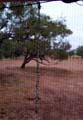
With the increasing humidity the flies get very "attached"; the
string hanging on the window's shutters is quite a sight ....
Once again we appreciate
our fly-screens.
It rains a bit more during the night.
In the morning ABC Radio
reports that the area around Burke had the best rainfall
in 7 years.
We also receive
an
email from
Marc and Teri Mendelson (Fellow travellers we made
while travelling through Alice Springs and had met again
in Perth last year) that the roads around Alice Springs
are boggy and they had
just made
it
back to
Alice
on time
before
the roads
were closed.
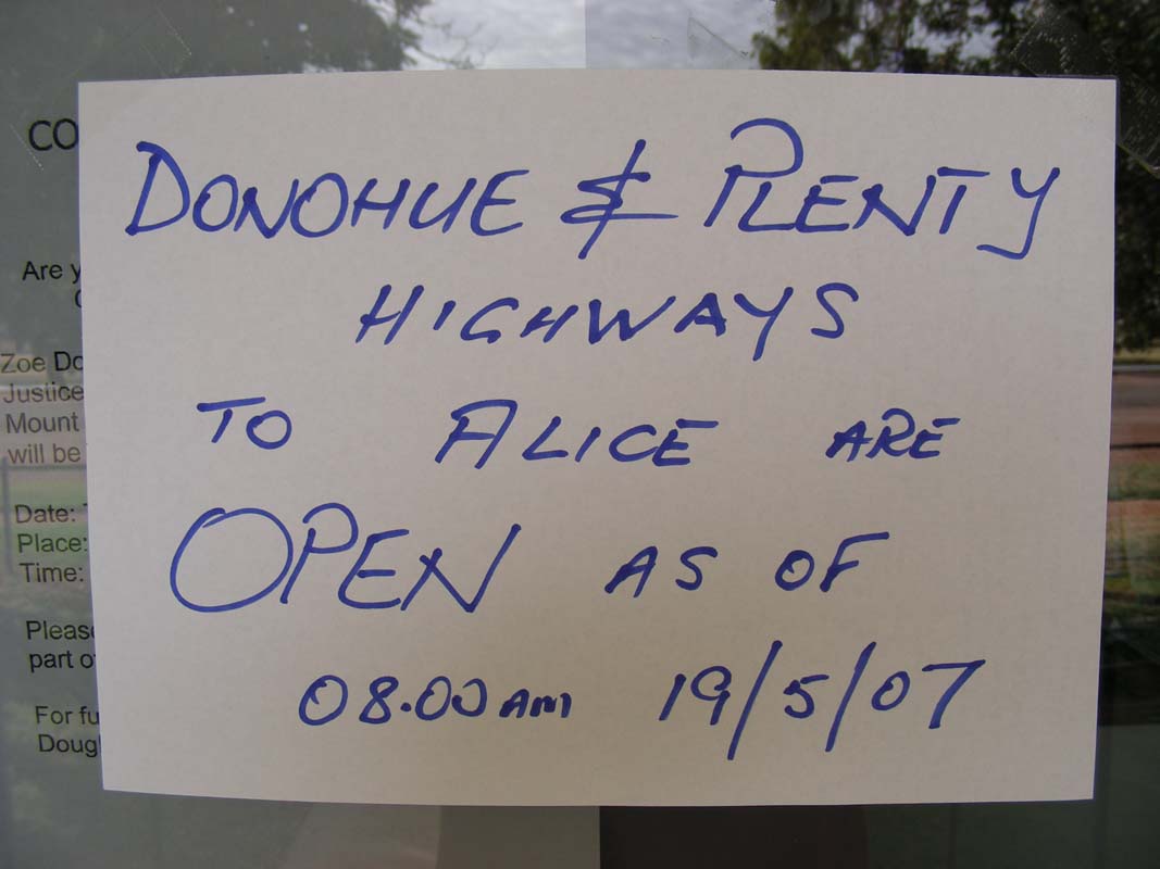
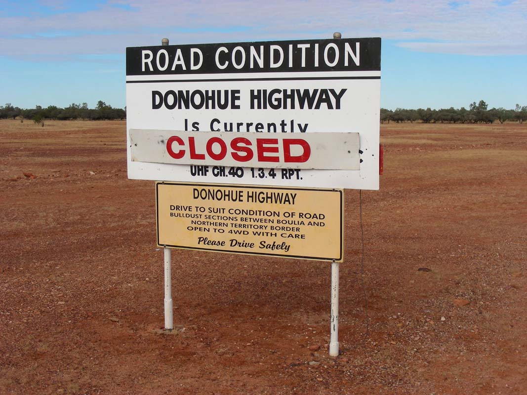
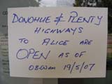
The road condition sign at the beginning of the Donohue Highway last
night had said “High
clearance vehicles only”.
We decide to check with the local police if this
is still the case.
Well, it is not.
The Donohue & Plenty Highways have been closed
and will stay closed until further notice.
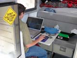
So we move to the local caravan park,
connect to power and start working on our web sites.
Even so we have a very powerful solar-system, it can not cope with fridge,
lights and 2 laptops operated for several days.
The day stays cool and windy with a max. temperature of only
22°C, but at least there
is no further rain and the humidity drops to 45% again.
On Saturday morning it is rather fresh with 15.4 °C
but the sun is breaking
through the clouds.
Ruedi checks the road report posted at the local Boulia Police station and is
informed
that the Donohue & Plenty Highways will reopen at 8 AM.
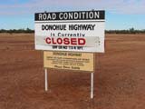
We leave but find the road sign at the turnoff onto the highway still saying “closed”.
Hmmm
... what now?
If you get caught driving on a closed road and
have caused damage to the road you can be charged with
the cost of having the road repaired, which can end up in
thousands
of dollars.
Road Trains are normally fined with at least 1000 AUD per
wheel (= 12 to 17 axles x 2 wheels x 1000 AUD).
Thanks to the Sat-Phone we can call the Boulia Police Stations (most
Police phone number are listed on the Hema maps) and double-check.
The officer is a bit surprised. She tries to call "Main Roads",
. Since they don't
work
on weekends, she cannot reach them. So she checks with the road-house at
the QLD/NT boarder.
When we call back a few minutes later she tells us that she has not been
able to contact the council, who is responsible for openings, closings and
road signs, but has spoken to Tobermorey Station, the first station in the
Northern Territory.
The Donohue Highway is open at least to the NT border, but they don't know
about the Plenty Highway as nobody has come through from Alice Spring yet.
The worst that could happen is that they stop us at the border and we would
have
to
wait
at Tobermorey
Station
until
the roads
are opened on the Northern Territory side.
So we leave.

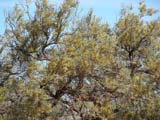

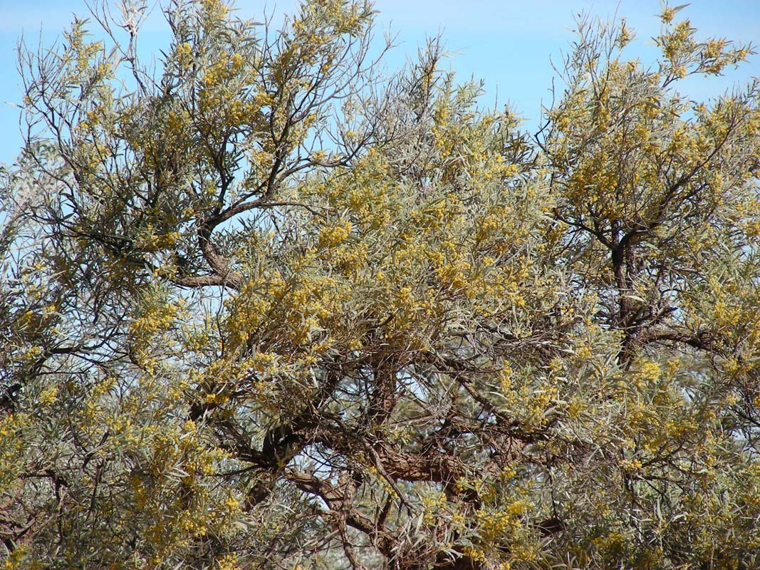
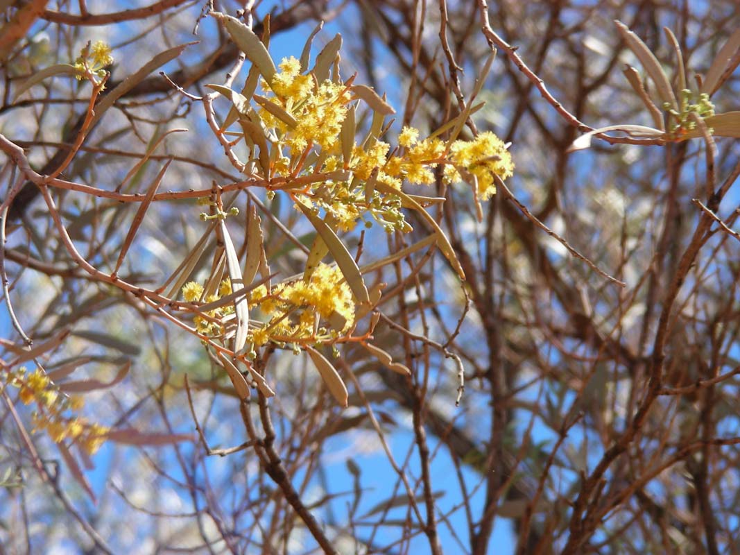
The country has changes its colours from the dry yellow to a light green.
Some of the plants have already started opening their flowers. In a day
or so some
bushes will be covered in bright yellow flowers.
Judging by the lush green grass the Georgina River area must have received
a fair bit of rain in the last few days.
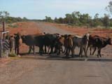
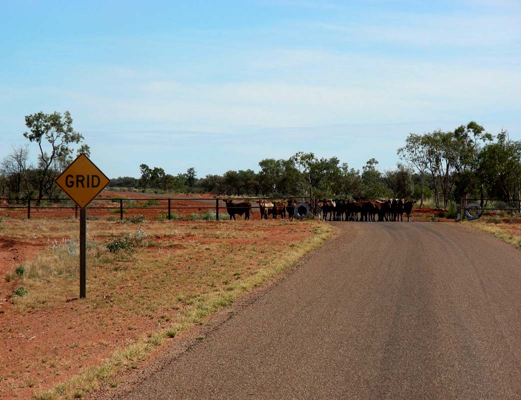
At one grid we find this mob of young cattle wanting to cross over into this
paddock but not daring to step on the grid.
On our side of the fence there is an enclosure with larger cattle in it. There
is lots of mooing going back and forth.
Looks like the youngsters have just
been separated from their mothers recently and are not impressed of being deprived
of their constant source of milk (Ruedi can fully understand them, as he also
would winch should missing out on his daily milk).
It takes a bit of gentle persuasion from the OKA's bull-bar to get them to
free the road and let us through. Even though we have a horn on our truck we
are better of not using it, as the "biests" would die of laughter.
Coming from the other side of the grid would have generated a bit more effort.
We should not approach cattle standing in front of a grid with the OKA as they
would probably try to flee across the grid thus breaking their legs.
We fill Diesel at Tobermorey Station located shortly after
the Queensland border.
They did not get any of the rain
out.
But as till now no vehicle
has come through from Alice Springs they can't tell
us anything new about the road conditions.
They have heard that there is
still water left
on the roads
and not always a way around the puddles.
As no rain is expected in the next days we decide to
continue and see how far we can get.

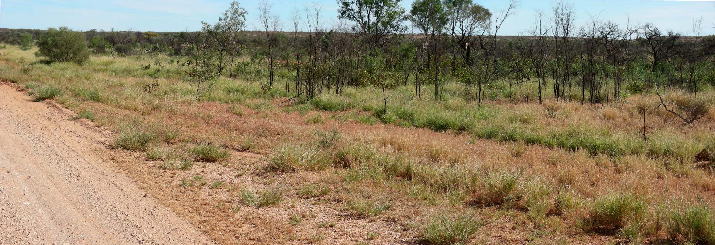
The country gets greener and greener.
Sometimes it doesn't look like the outback
at all, more like a well irrigated park.
It is amazing.
But the road gets
rougher too.
We see brolgas and other water birds indicating that there
must be larger puddles of water in the area.
A car comes towards us
but does not stop as it passes us.
Did it come from Alice Springs or did it turn around we wonder
...
Again we drive through vast flat plains; the Toko
Range is
a welcome change in scenery.
The area around Mt. Guide must have received
a fair bit of rain.
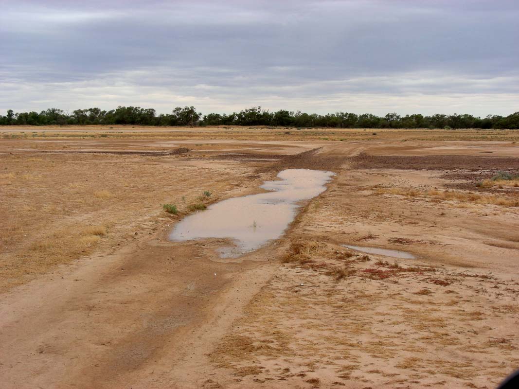
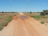
The road is still very soft and many
puddle of water are still
on the road;
driving
around
them is like driving slalom.
The Algamba Creek crossing would have
been closed yesterday… water lays on the side of the
road, the drains on the side of the road are filled with
water.
Even the Tarlton
Range seems to have
a green
cover.
We decide to camp near the Arthur Creek.
The Sunday morning is a cold morning with only 8°C
outside.
Its a fair change from the 22.6°C before sunrise we
had at the Diamantina just a few days ago, if one considers
that it is only 500 km away in easterly direction ....
But we have cosy
16.8°C inside the cabin and the sun warms through the large windows.
Still,
for Susi it is time to exchange the shorts for long trousers, winter is coming.
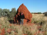
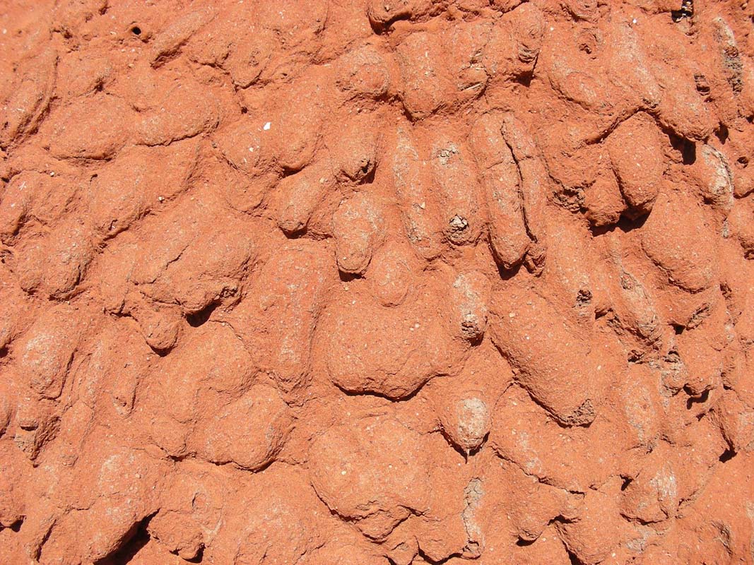
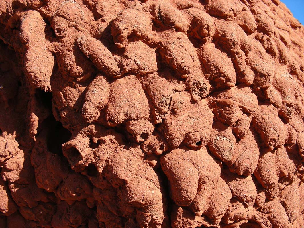
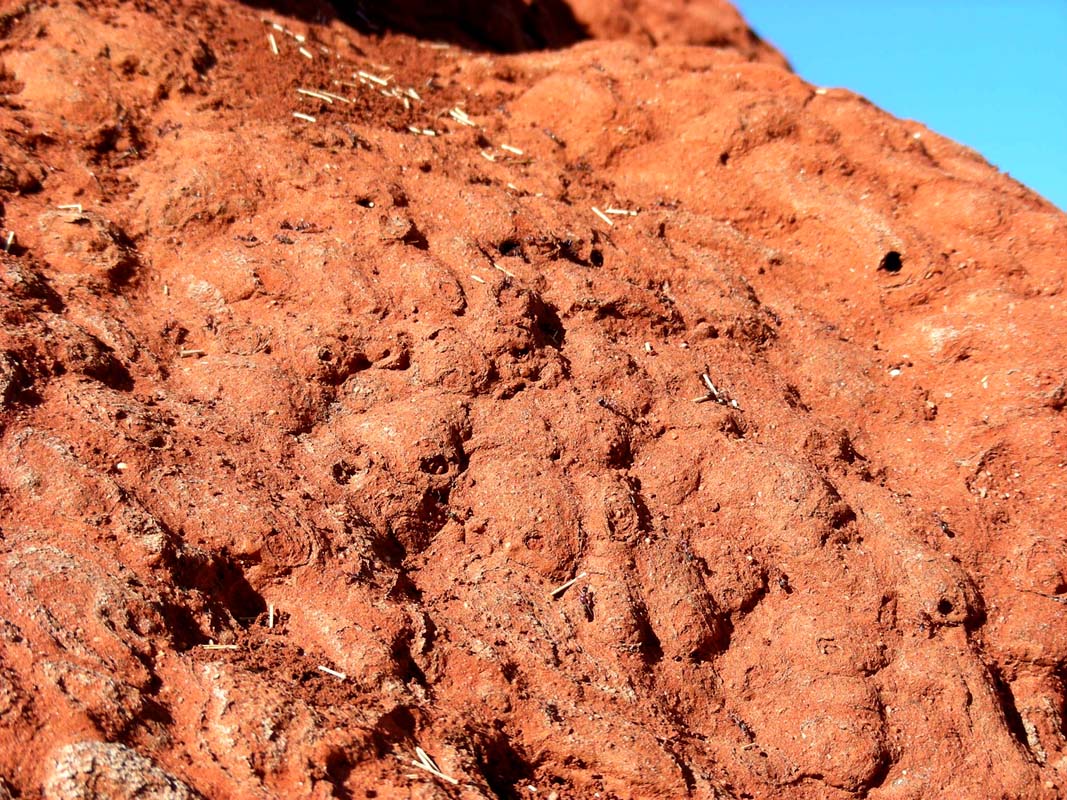
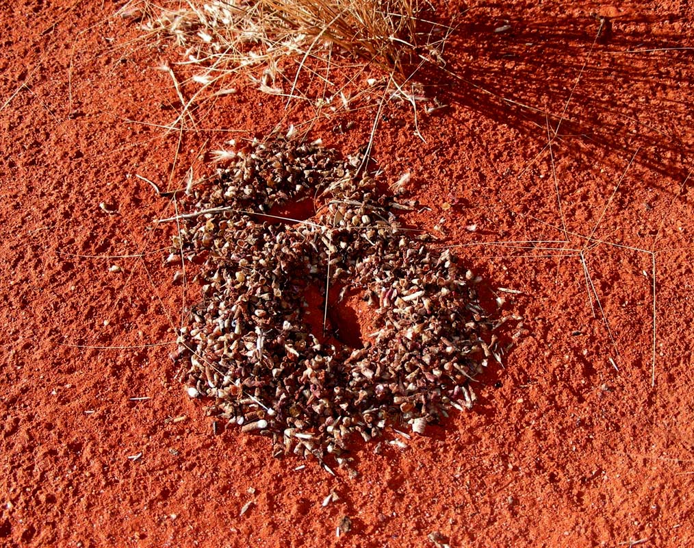
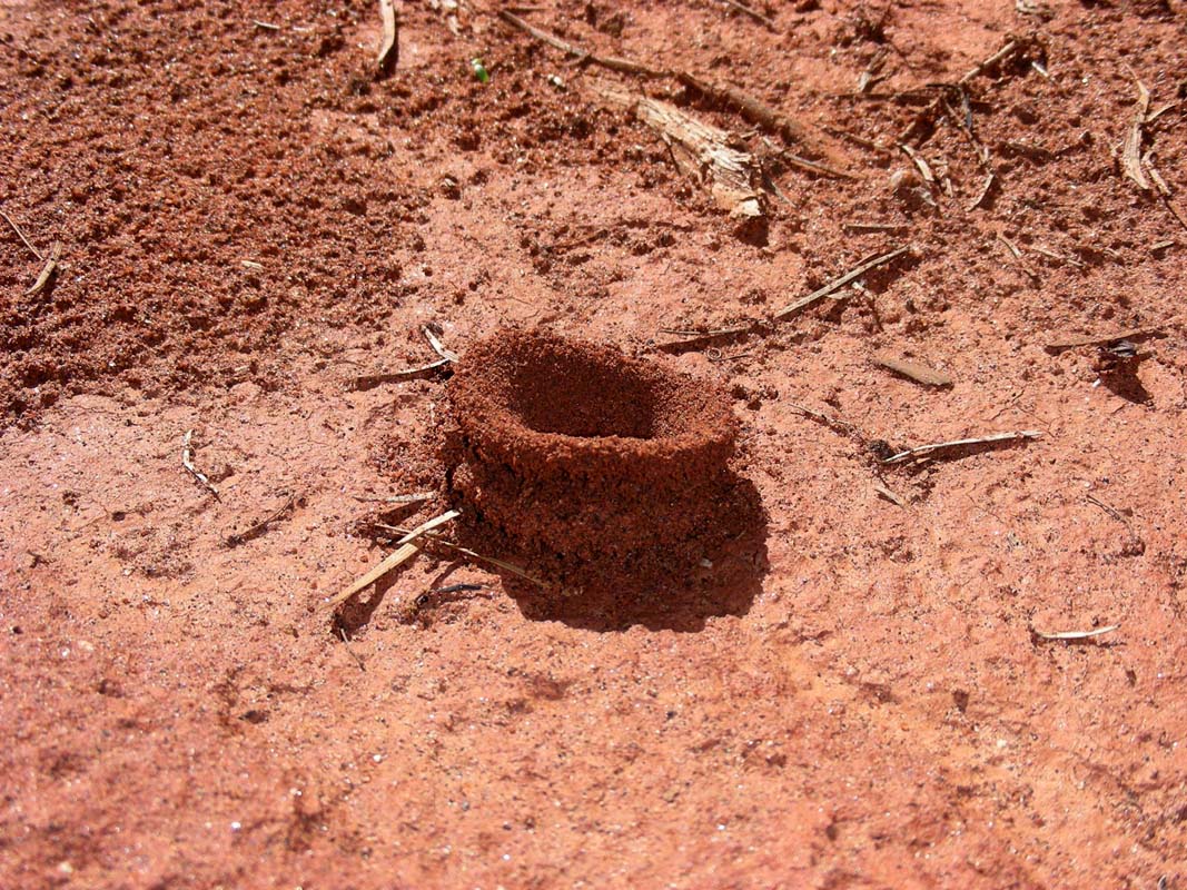
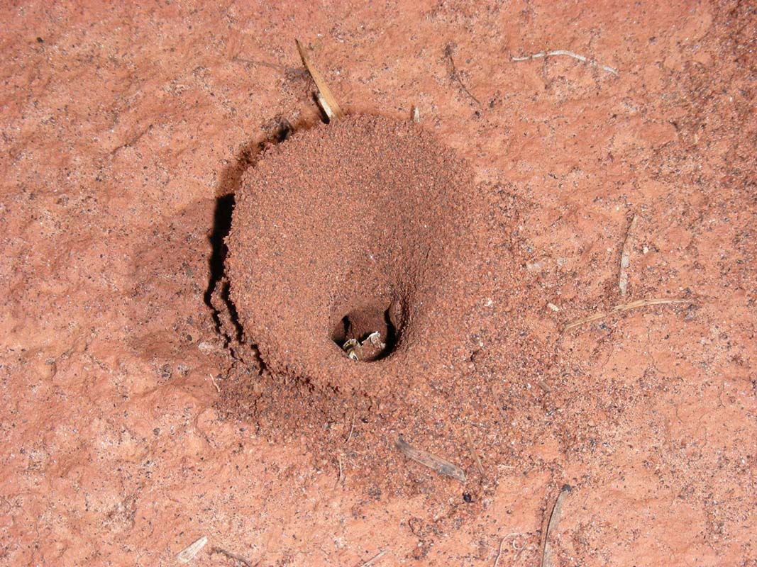
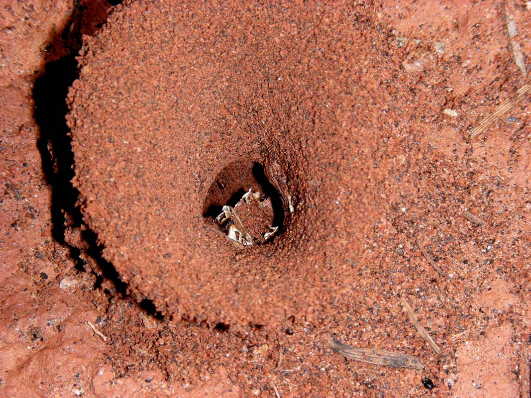
We hit the dirt gain and soon after stop to have a look at
the large Spinifex
termite mounts on the side of the road.
If you think that this one is big, then click
here
...
We are impressed about the workmanship the termites show.
For such small animals it must be a huge task to complete
mounts like these.
Also some bird species have found it to be a reliable source
of food, pecking holes into the mount to access the seeds.
It is also a very practical place to nest and lay eggs
as the temperature is kept stable by the termites.

It looks like the black ants steel the Spinifex seeds from
the termites.
Some of them have actually moved right into
the termite mount or very close by …
Today the Plenty Highway must
have officially been opened again.
In
less than 30 minutes we are passed by 2 cars and crossed
by one.

We pass Boundary Hill, Mount
Cornish and the Jervois Range,
some red hills that look very nice with
their yellow Spinifex grass covering.

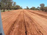
Here there is a different sort of soil, more like
red sand and we encounter some badly corrugated stretches of road. The OKA masters
the corrugation smooth as ever due to the large wheels, the
reduced tyre pressure and the soft suspension. Like a desert-ship
(camel).
Ruedi has
to really concentrate on where to drive.
Some more cars cross us, some driven in a real rush. We
normally reduce our speed close to zero, to avoid the hail
of stones this idiots generate.
It really looks like they had kept
the Plenty Hwy closed
on the Northern Territory side yesterday.
The Plenty River Mica Mining Area is the ending of the flat
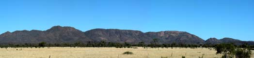
and open plane.
After all these flat stretches the Harts
Range is impressive.

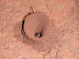

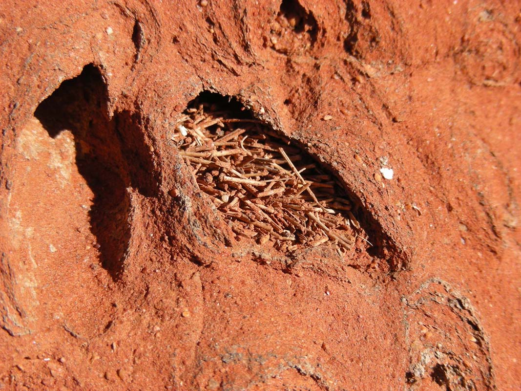
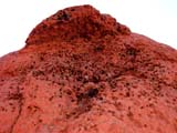
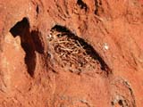
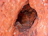
We find this nest.
The animal living in it closes the
entry of the nest with a white net during night.
We had seen it previously
in Kalgoorly. To our disgrace we must admit that we still
don't know what animal it is ...
We pass more and more
hills; many "waves" have to be crossed.

The Harts Range area must have received
rain in the last few days.
The road is pretty
bad, even some puddles of water are left on it.
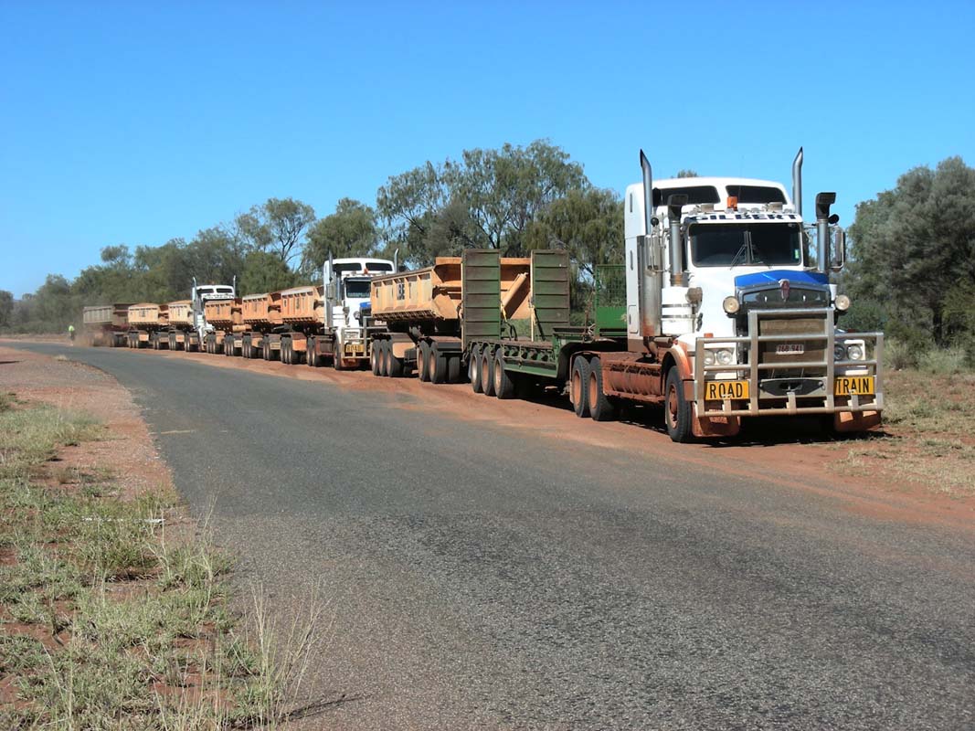
We get passed by some road trains.
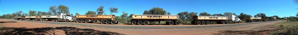

We see them again when
we reach the bitumen part of the Plenty Highway and they “dust” their
tyres (= stopping and getting as much dust and sand off
the tyres before they head into town. If they would not
do that the first place where they stop would be marked
with small sand piles …)


Reached the bitumen again means that Ruedi has
to pump the tyres.
Thanks to the OKA's compressed air it is done quickly.
It is amazing how green the country has become. When we came
through the Strangways Range last
year it had all been
yellow and burned.
The cows for certain
enjoy a good feed of lush green grass and a bit of a splashing
around in the last few puddles
on the side of the road.
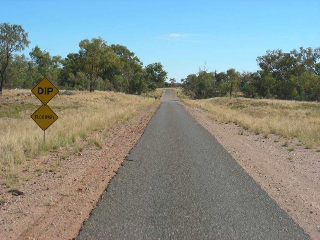
As we turn into the Stuart Highway we
see speed restriction signs for 130 km/h… ah yes,
they only
just recently implemented speed restrictions in the Northern
Territory!
We
also hear on the radio that there is a white LandCruiser parked on the side
of the road shortly after one of the new signs …
Well, no problem for
us as we only drive with 90 km/h to keep the fuel consumption on a more or
less acceptable
level.
We turn into the Tanami Road in search of the Painter
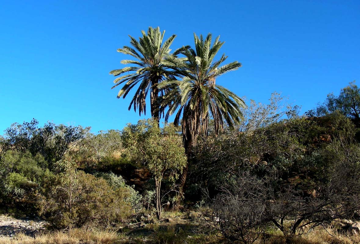
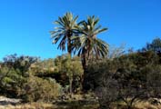
Springs.
We find them but the water has ceased to flow. All
that is left are two palms and the clogged up pipe of the
bore.
We decide to stay there for the night.
The temperature drops to 12.6°C over night.
It is Monday, May 21 2007, and the shops will be open in
Alice Springs, so we pack up and leave towards Alice Springs.
But first we have to find our way back to the Tanami Road.
The
track
we have been following gets
fainter
and
fainter,
not
too many
cars
have
driven
it
lately, roads shown on the maps
do not exist anymore ...
And suddenly we stand in front of a fence. We see the track
on the other side and after some searching also finds a
gate.
Getting through it is another story as the trees
are too narrow for the OKA to get through, the track is badly washed out or
goes
a
cross
the
soft sand
of
the creek bed.
To assist Susi indicates the best way through, runs ahead and doesn't watch
where she steps.
Sure enough she stumbles.
To avoid falling into thorns with her hands she turn the body ... with the result
that now her bum is sitting in the thorns!
The worse is that she need Ruedi's help to fix it ... sorry, but somehow we
missed it to catch it all on camera ...
After shopping in Alice Springs we check in
at the Big4 Caravan Park where Marc and Teri
Mendelson
are
waiting
for
us.
We discuss further travel plans but decide to give ourselves
some time to get this web update done.
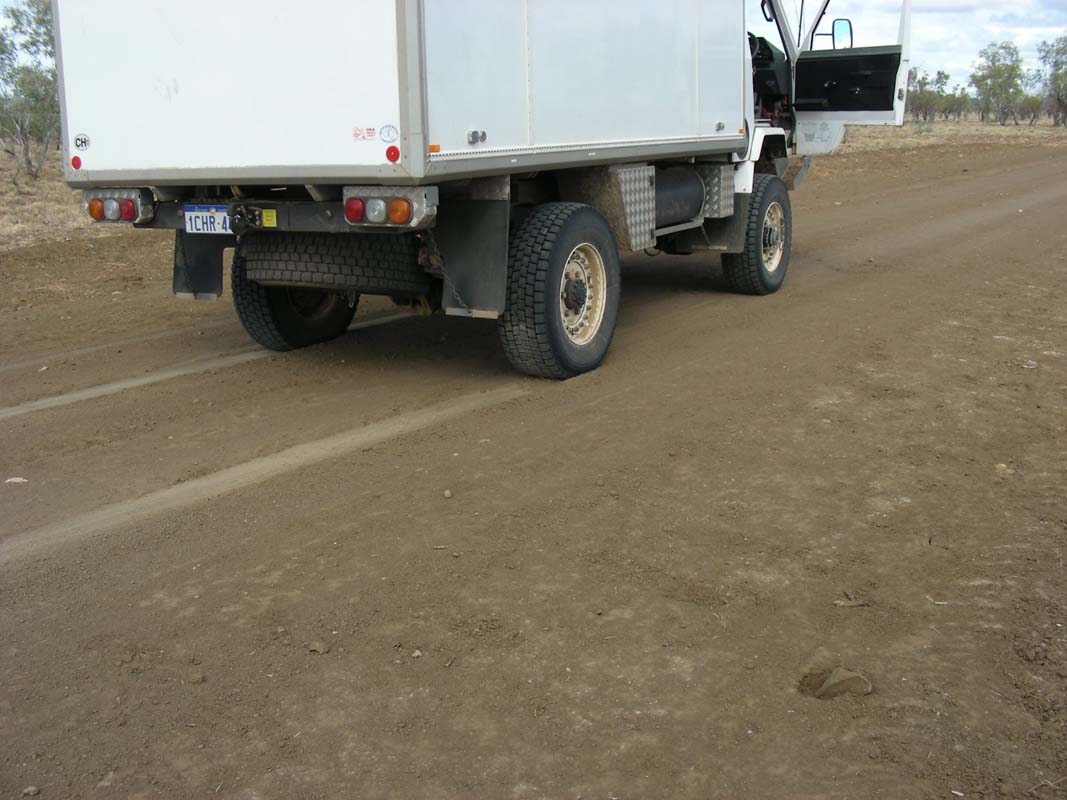
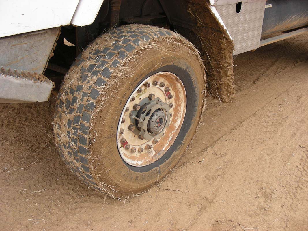
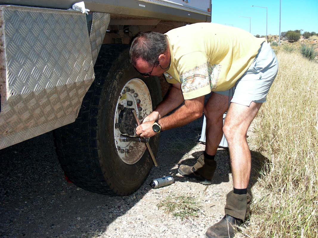
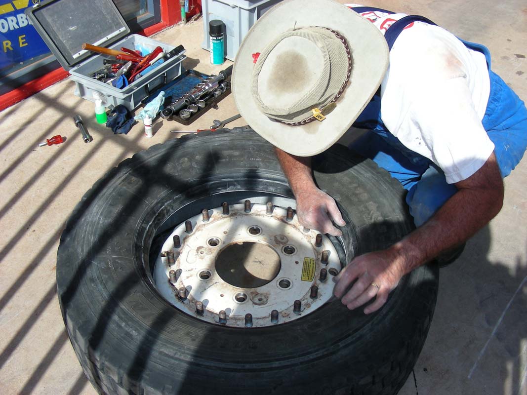
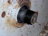
The next morning we head into town and arrange for a tire
to be fixed.
The tyre got damaged on the side wall.
As it is not deep we
want to try out a technique, where a rubber
patch to the damage on the side wall and baked it in at approx.
80°C for a few hours so the rubber combines with the tire's
rubber.
It only costs 40 AU$. The only
other alternative is to throw away a 700 AU$ tyre and buy a
new one ....
Ruedi exchanges the wheel with the spare wheel, but he
misses to correctly tighten the wheel nuts with the
torque spanner.
Instead he does it by gut feeling, knowing that he will
do it the correct way anyway roughly 10 kilometres
later.
This sloppiness proves to be fatal as a few kilometres
later while driving at 80 kmh, all the nuts loosen and
we almost
lose the wheel.
This is our
first,
really dangerous incident.
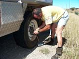
All the threads are damaged but since the nuts are harder
than the studs, Ruedi can rethread them with grease and lots
of muscle power.
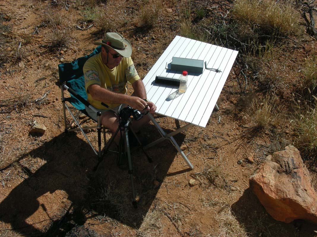
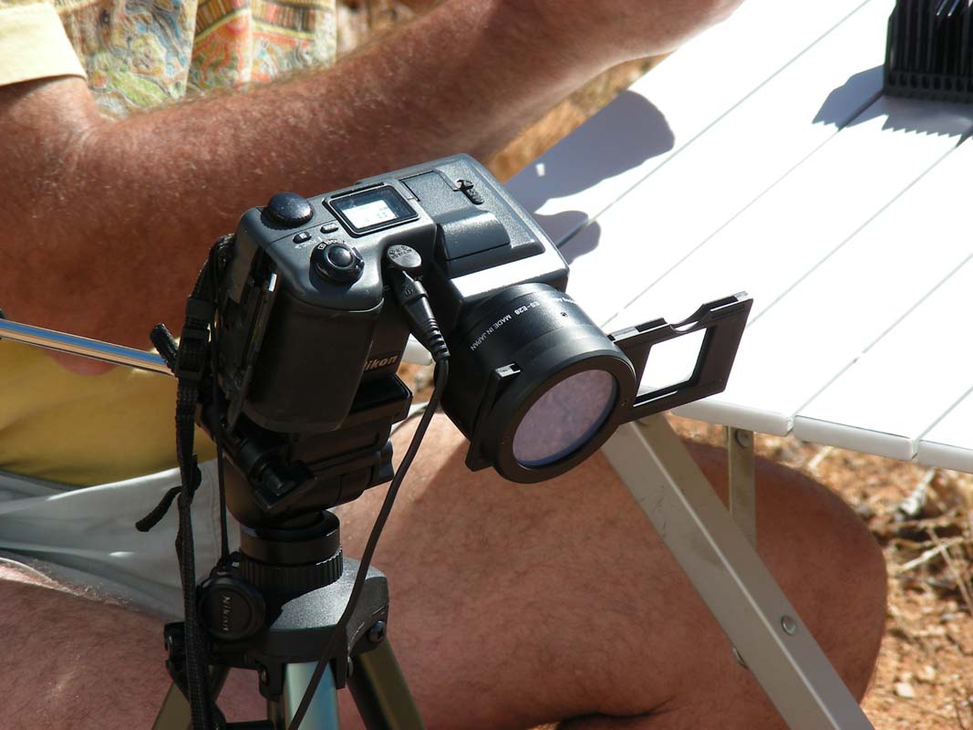
We find ourselves a little spot just within reach of the
Alice Springs Internet reception and will stay here until
the work is done ....
... we are converting slides into jpegs ..... 
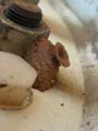
Amazing how fast little critters make
themselves at home once you stand still for a few days.
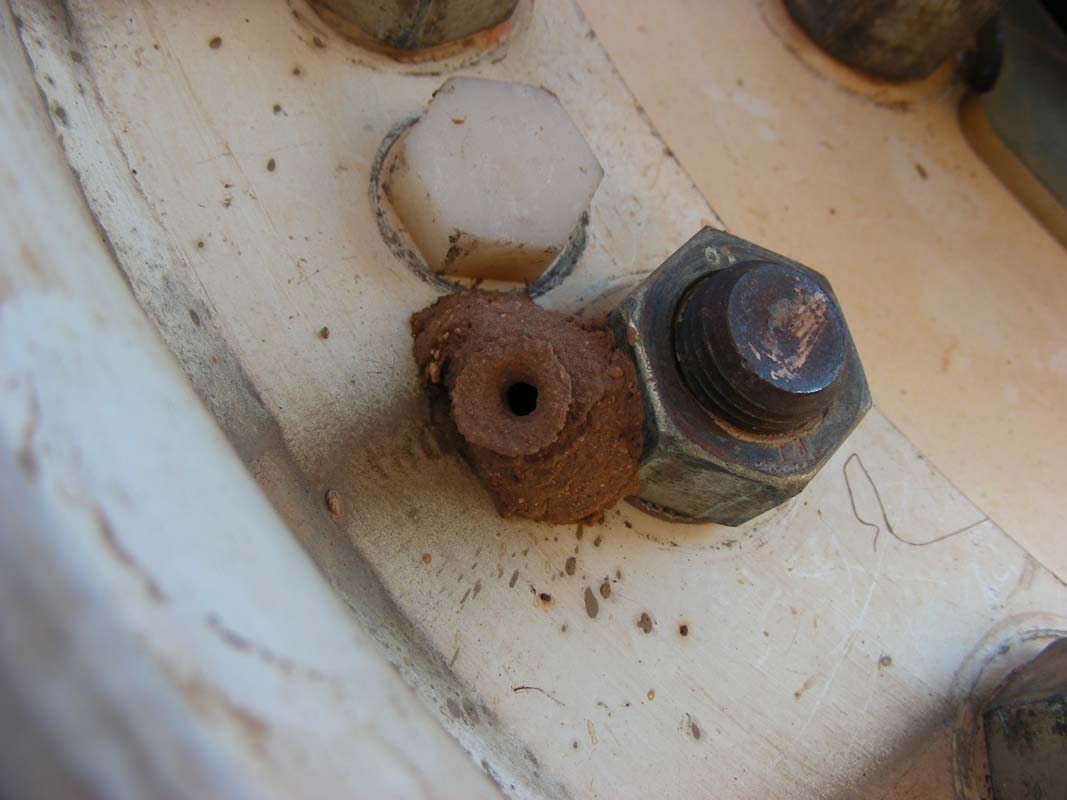
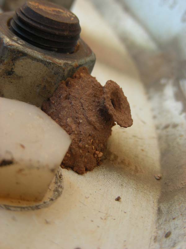
The
nest of a mud-wasp on our front tyre even survived a trip
into Alice Springs at 80 kmh.
The mud-wasp must feel as much at home
on our OKA as we do in it!
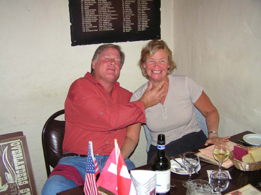
For the weekend we decide to stay at the Big4 and discuss
the travel plans in detail with Marc and Teri.
When walking through the park to see what kind of rigs have
checked in we see this one ....
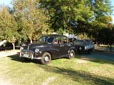
This must be one of the smallest set-ups we have seen so
far.
It brings memories of the photos we have seen of our friends
Peter and Margaret (owners of OKA 196) when they travelled
the Outback Australia (including the Simpson Desert) with
their Mini Cooper in the 70s ....
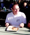
On Saturday evening
we head into town have a jolly good time.
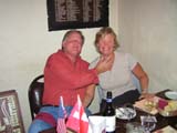

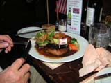
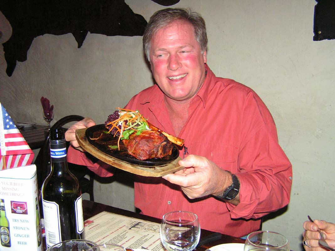
Marc suggest going to the Overlanders Steakhouse, famous
for its steaks ..... and he wants to teach us what a "wobble
board" is
and how to use it ....
Click here  to view the movie. to view the movie.
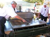
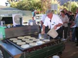

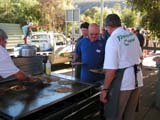
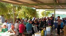
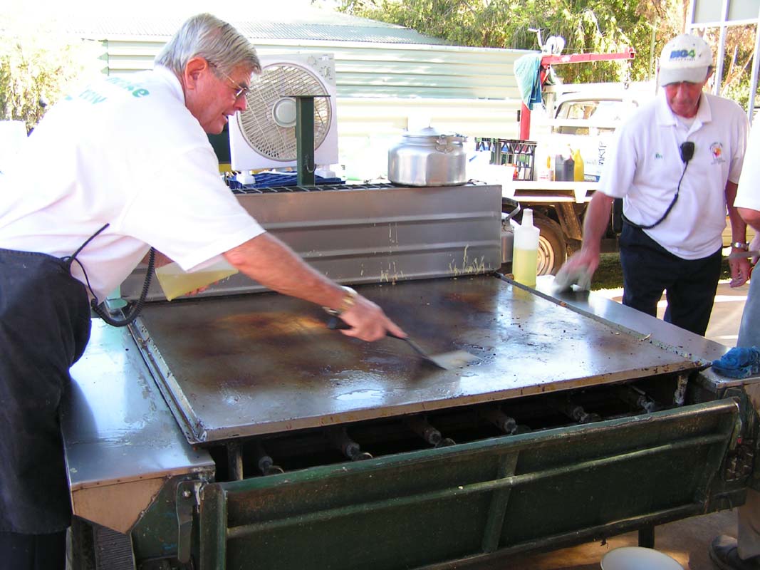
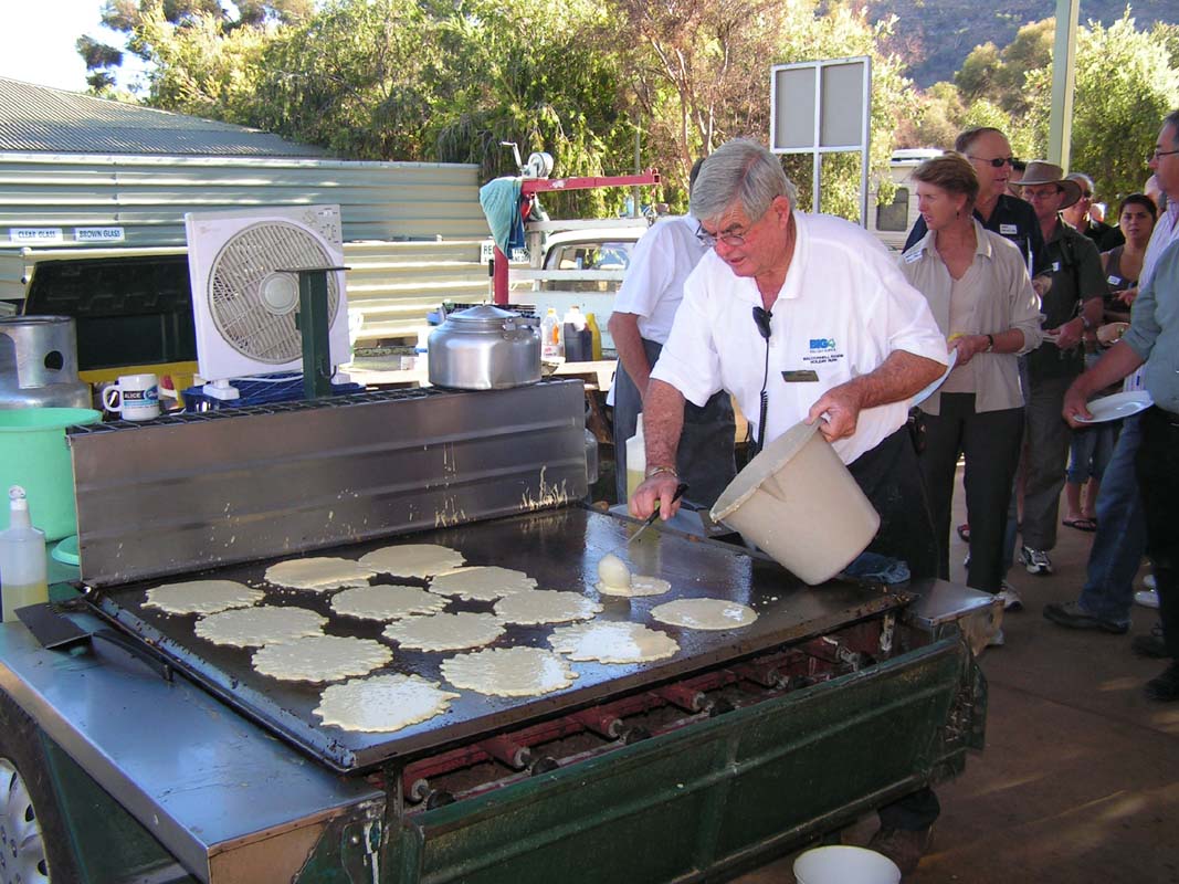
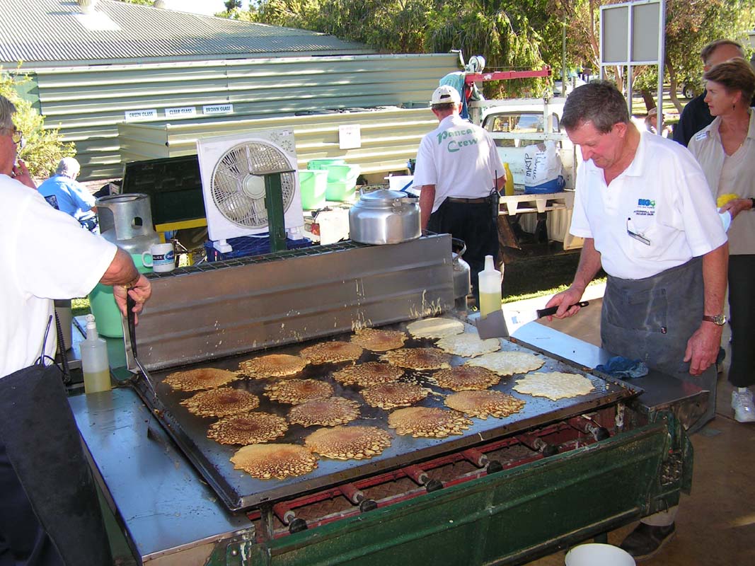
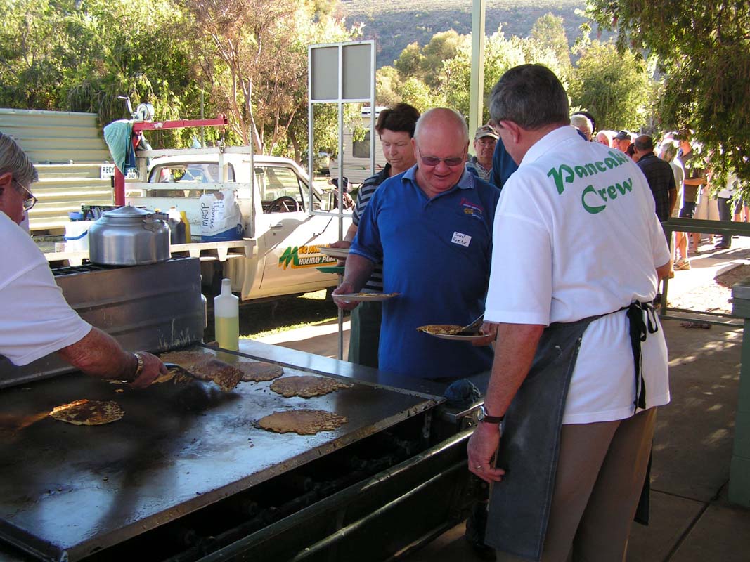
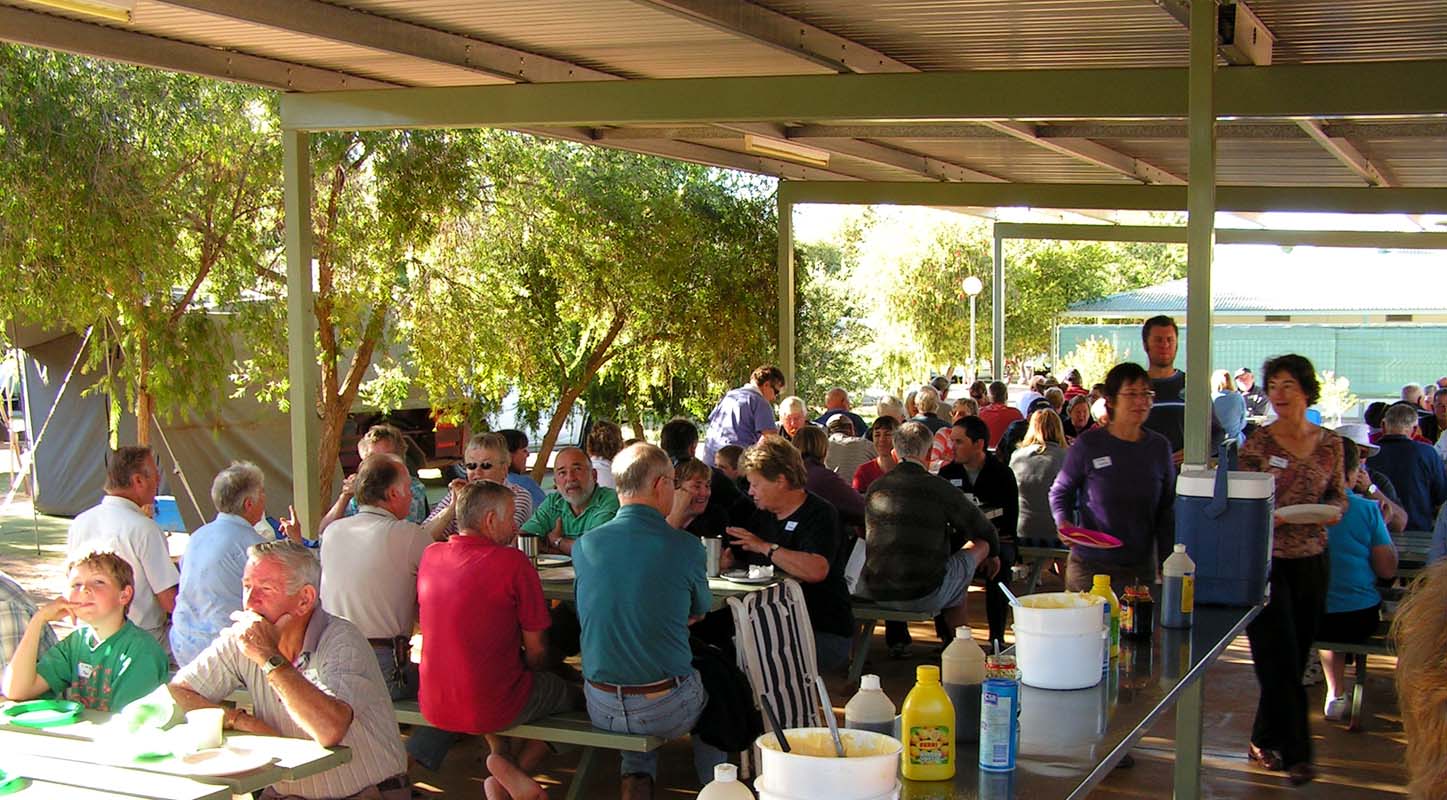
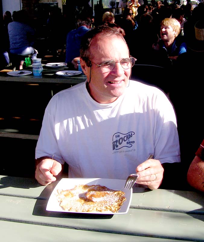
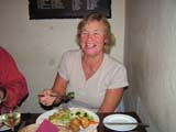
On Sunday morning it is pancake time at the Big4.
The Caravan Park offers a free pancake breakfast with all
the trimmings for the tenants.
You just get your plate
and queue up as many times as you want
(they cook up to 600
Pancakes.)
It is a good occasion to exchange route details with other
people and the pancakes are really yummy!
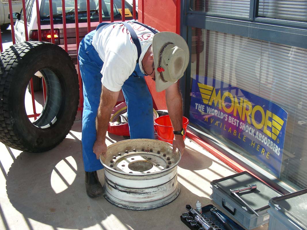
On Monday we pick up the tire. Because of the Bead Locks
and the bolt-togheter rims Ruedi decides to assemble the
tire
on his own.
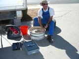
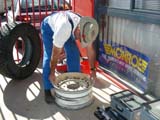
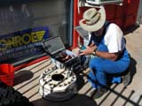

It is tedious work
and has to be done with great care as otherwise the tire
will leak.
The tyre is places over the bottom part of the rim.
The tubeless valve is fitted.
The
tube for the beadlock is inserted, the Kevlar beadlock placed
around it and the beadlock tube pumped a bit.
Then
a large O-ring is fitted in the bottom part of the rim and
the top port of the rim carefully placed on it. This part
is the tricky one as the O-ring is the seal between the two
metal rims. If this is not done well the tyre will leak.
By tightening the bolts of the rim slowly and regularly the
O-ring is pressed into its place thus sealing the rims.
Sounds easy but it is some 4 hours of work ....
|